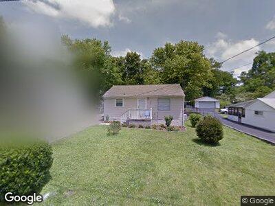
109 Laurel Dr Unit 2 Chattanooga, TN 37415
Estimated Value: $202,000 - $248,000
2
Beds
1
Bath
832
Sq Ft
$275/Sq Ft
Est. Value
About This Home
This home is located at 109 Laurel Dr Unit 2, Chattanooga, TN 37415 and is currently estimated at $228,765, approximately $274 per square foot. 109 Laurel Dr Unit 2 is a home located in Hamilton County with nearby schools including Red Bank Elementary School, Red Bank Middle School, and Red Bank High School.
Ownership History
Date
Name
Owned For
Owner Type
Purchase Details
Closed on
Nov 8, 2011
Sold by
Hagadorn Kaye F
Bought by
Brown Kimberly A and Brown David A
Current Estimated Value
Home Financials for this Owner
Home Financials are based on the most recent Mortgage that was taken out on this home.
Original Mortgage
$52,000
Outstanding Balance
$8,547
Interest Rate
4.09%
Mortgage Type
New Conventional
Estimated Equity
$218,520
Purchase Details
Closed on
Oct 31, 1995
Bought by
Hagadorn Kaye F
Purchase Details
Closed on
Jul 26, 1995
Bought by
Secretary Of Housing & Urb
Create a Home Valuation Report for This Property
The Home Valuation Report is an in-depth analysis detailing your home's value as well as a comparison with similar homes in the area
Home Values in the Area
Average Home Value in this Area
Purchase History
| Date | Buyer | Sale Price | Title Company |
|---|---|---|---|
| Brown Kimberly A | $72,000 | Equititle Inc | |
| Hagadorn Kaye F | -- | -- | |
| Secretary Of Housing & Urb | -- | -- |
Source: Public Records
Mortgage History
| Date | Status | Borrower | Loan Amount |
|---|---|---|---|
| Open | Brown Kimberly A | $52,000 |
Source: Public Records
Tax History Compared to Growth
Tax History
| Year | Tax Paid | Tax Assessment Tax Assessment Total Assessment is a certain percentage of the fair market value that is determined by local assessors to be the total taxable value of land and additions on the property. | Land | Improvement |
|---|---|---|---|---|
| 2024 | $647 | $28,900 | $0 | $0 |
| 2023 | $1,199 | $28,900 | $0 | $0 |
| 2022 | $1,004 | $28,900 | $0 | $0 |
| 2021 | $1,196 | $28,900 | $0 | $0 |
| 2020 | $1,019 | $19,025 | $0 | $0 |
| 2019 | $1,019 | $19,025 | $0 | $0 |
| 2018 | $1,019 | $19,025 | $0 | $0 |
| 2017 | $979 | $19,025 | $0 | $0 |
| 2016 | $972 | $0 | $0 | $0 |
| 2015 | $972 | $18,075 | $0 | $0 |
| 2014 | $972 | $0 | $0 | $0 |
Source: Public Records
Map
Nearby Homes
- 203 Flora Cir
- 2621 Berkley Dr
- 3117 Carlton Ave
- 107 W Newberry St
- 105 P'Poole Ave
- 2524 Woodfin Ave
- 2510 Nonova Ln
- 201 Signal View St
- 220 Cliftview Dr
- 3223 Redding Rd
- 116 Signal View St
- 114 Signal View St
- 2535 Leaning Tree Ln
- 3300 Redding Rd
- 3210 Joselin Ln
- 2430 Ashmore Ave
- 5 Gaylord Dr
- 918 Lullwater Rd
- 3416 Dayton Blvd
- 2301 Ashmore Ave