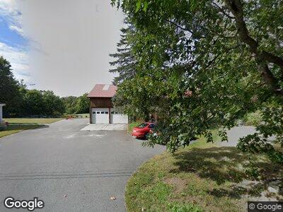
1098 Main St Dunstable, MA 01827
Estimated Value: $747,591 - $889,000
3
Beds
3
Baths
2,852
Sq Ft
$280/Sq Ft
Est. Value
About This Home
This home is located at 1098 Main St, Dunstable, MA 01827 and is currently estimated at $797,148, approximately $279 per square foot. 1098 Main St is a home located in Middlesex County with nearby schools including Groton Dunstable Regional High School and 2nd Nature Academy.
Ownership History
Date
Name
Owned For
Owner Type
Purchase Details
Closed on
Mar 10, 2021
Sold by
Axon Donald
Bought by
Axon Sara A
Current Estimated Value
Purchase Details
Closed on
Mar 29, 2002
Sold by
Thompson Judith A and Leslie Thompson C
Bought by
Axon Sara A and Axon Donald
Home Financials for this Owner
Home Financials are based on the most recent Mortgage that was taken out on this home.
Original Mortgage
$150,000
Interest Rate
6.88%
Mortgage Type
Purchase Money Mortgage
Purchase Details
Closed on
Dec 2, 1999
Sold by
Spencer Peter
Bought by
Thompson C Leslie
Home Financials for this Owner
Home Financials are based on the most recent Mortgage that was taken out on this home.
Original Mortgage
$167,500
Interest Rate
7.86%
Mortgage Type
Purchase Money Mortgage
Purchase Details
Closed on
Mar 30, 1999
Sold by
Barros Leonard A and Barros Lisa E
Bought by
Spencer Peter
Create a Home Valuation Report for This Property
The Home Valuation Report is an in-depth analysis detailing your home's value as well as a comparison with similar homes in the area
Home Values in the Area
Average Home Value in this Area
Purchase History
| Date | Buyer | Sale Price | Title Company |
|---|---|---|---|
| Axon Sara A | -- | None Available | |
| Axon Sara A | $300,000 | -- | |
| Thompson C Leslie | $267,500 | -- | |
| Spencer Peter | $219,500 | -- |
Source: Public Records
Mortgage History
| Date | Status | Borrower | Loan Amount |
|---|---|---|---|
| Previous Owner | Barros Leonard A | $100,400 | |
| Previous Owner | Barros Leonard A | $150,000 | |
| Previous Owner | Barros Leonard A | $167,500 |
Source: Public Records
Tax History Compared to Growth
Tax History
| Year | Tax Paid | Tax Assessment Tax Assessment Total Assessment is a certain percentage of the fair market value that is determined by local assessors to be the total taxable value of land and additions on the property. | Land | Improvement |
|---|---|---|---|---|
| 2025 | $9,185 | $668,000 | $226,400 | $441,600 |
| 2024 | $8,828 | $632,400 | $206,900 | $425,500 |
| 2023 | $8,983 | $600,100 | $206,900 | $393,200 |
| 2022 | $8,741 | $573,200 | $206,900 | $366,300 |
| 2021 | $7,652 | $466,300 | $189,000 | $277,300 |
| 2020 | $7,394 | $439,100 | $189,000 | $250,100 |
| 2019 | $7,244 | $424,600 | $189,000 | $235,600 |
| 2018 | $6,965 | $397,100 | $187,400 | $209,700 |
| 2017 | $6,759 | $397,100 | $187,400 | $209,700 |
| 2016 | $6,655 | $402,100 | $179,200 | $222,900 |
| 2015 | $6,356 | $379,900 | $151,500 | $228,400 |
| 2014 | $5,999 | $380,400 | $151,500 | $228,900 |
Source: Public Records
Map
Nearby Homes
- 67 Groton Rd Unit C
- 35 Pinebrook Rd
- 44 Diamondback Ave
- 67 Wilderness Dr Unit The Cub
- 46 Wilderness Dr Unit Derby 2
- 2 Scout Ln Unit The Eagle
- 1 Scout Ln Unit Derby 2
- 71 Wilderness Dr Unit The Eagle
- 69 Wilderness Dr Unit The Cub
- 58 Wilderness Dr Unit The Scout
- 73 Wilderness Dr Unit The Eagle
- 473 High St
- 4 Doucet Ave Unit The Scout
- 68 Barrington Ave
- 4 Pioneer Dr
- 13 Satin Ave
- 29 Goldfinch Ln Unit U86
- 4 Ponderosa Ave
- 9 Cadogan Way Unit UP203
- 57 Green Heron Ln Unit U65