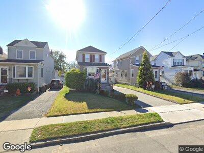
11 Davis St East Rockaway, NY 11518
Estimated Value: $598,000
--
Bed
1
Bath
1,022
Sq Ft
$585/Sq Ft
Est. Value
About This Home
This home is located at 11 Davis St, East Rockaway, NY 11518 and is currently estimated at $598,000, approximately $585 per square foot. 11 Davis St is a home located in Nassau County with nearby schools including East Rockaway Junior/Senior High School and Our Lady Of Peace School.
Ownership History
Date
Name
Owned For
Owner Type
Purchase Details
Closed on
Sep 19, 2011
Sold by
Sciacca Bennett and Sciacca Bartholomew
Bought by
Maniscalco Vincent
Current Estimated Value
Home Financials for this Owner
Home Financials are based on the most recent Mortgage that was taken out on this home.
Original Mortgage
$105,000
Outstanding Balance
$73,084
Interest Rate
4.15%
Mortgage Type
Purchase Money Mortgage
Estimated Equity
$524,916
Purchase Details
Closed on
Jul 2, 2009
Sold by
Sciacca Maria
Bought by
Sciacca Bennett and Sciacca Bartholomew
Create a Home Valuation Report for This Property
The Home Valuation Report is an in-depth analysis detailing your home's value as well as a comparison with similar homes in the area
Home Values in the Area
Average Home Value in this Area
Purchase History
| Date | Buyer | Sale Price | Title Company |
|---|---|---|---|
| Maniscalco Vincent | $275,000 | -- | |
| Sciacca Bennett | -- | -- |
Source: Public Records
Mortgage History
| Date | Status | Borrower | Loan Amount |
|---|---|---|---|
| Open | Maniscalco Vincent | $105,000 |
Source: Public Records
Tax History Compared to Growth
Tax History
| Year | Tax Paid | Tax Assessment Tax Assessment Total Assessment is a certain percentage of the fair market value that is determined by local assessors to be the total taxable value of land and additions on the property. | Land | Improvement |
|---|---|---|---|---|
| 2024 | $1,532 | $399 | $176 | $223 |
| 2023 | $6,699 | $377 | $163 | $214 |
| 2022 | $6,699 | $408 | $176 | $232 |
| 2021 | $10,250 | $396 | $171 | $225 |
| 2020 | $6,269 | $433 | $376 | $57 |
| 2019 | $5,474 | $464 | $306 | $158 |
| 2018 | $5,431 | $611 | $0 | $0 |
| 2017 | $5,268 | $611 | $350 | $261 |
| 2016 | $6,663 | $611 | $350 | $261 |
| 2015 | $1,577 | $704 | $403 | $301 |
| 2014 | $1,577 | $704 | $403 | $301 |
| 2013 | $1,468 | $704 | $403 | $301 |
Source: Public Records
Map
Nearby Homes
- 9 Dart St
- 153 Main St
- 92 Lawson Ave
- 51 Davison Ave
- 22 Adams St
- 117 Grant Ave
- 55 Waldo Ave
- 49 Waldo Ave
- 490 Atlantic Ave Unit 330
- 490 Atlantic Ave Unit 228
- 490 Atlantic Ave Unit 217
- 35 Franklin St
- 6 Howland Rd
- 30 Edwin Ct
- 54 North Blvd
- 16 Sachem St
- 34 Sachem St
- 66 Denton Ave
- 28 North Blvd
- 208 Rhame Ave