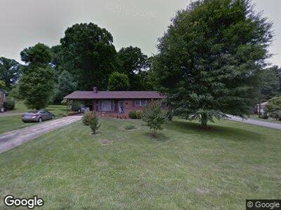
111 Woodcliff Dr Morganton, NC 28655
Estimated Value: $231,000 - $272,000
3
Beds
2
Baths
1,136
Sq Ft
$221/Sq Ft
Est. Value
About This Home
This home is located at 111 Woodcliff Dr, Morganton, NC 28655 and is currently estimated at $250,728, approximately $220 per square foot. 111 Woodcliff Dr is a home located in Burke County with nearby schools including Hillcrest Elementary School, Walter R. Johnson Middle School, and Freedom High School.
Ownership History
Date
Name
Owned For
Owner Type
Purchase Details
Closed on
Nov 28, 2022
Sold by
Buff Debra Mcfarland
Bought by
Mcfarland Buff Debra and Buff Scott Tonya
Current Estimated Value
Purchase Details
Closed on
Jul 20, 2020
Sold by
Mcfarland James Kenneth
Bought by
Buff Debra Mcfarland
Purchase Details
Closed on
Feb 8, 2018
Sold by
Mcfarland James Reed
Bought by
Mcfarland James Kenneth and Buff Debra Mcfarland
Create a Home Valuation Report for This Property
The Home Valuation Report is an in-depth analysis detailing your home's value as well as a comparison with similar homes in the area
Home Values in the Area
Average Home Value in this Area
Purchase History
| Date | Buyer | Sale Price | Title Company |
|---|---|---|---|
| Mcfarland Buff Debra | -- | -- | |
| Buff Debra Mcfarland | $20,000 | None Available | |
| Mcfarland James Kenneth | -- | None Available |
Source: Public Records
Mortgage History
| Date | Status | Borrower | Loan Amount |
|---|---|---|---|
| Previous Owner | Mcfarland James Reed | $50,000 | |
| Previous Owner | Mcfarland James Reed | $38,878 |
Source: Public Records
Tax History Compared to Growth
Tax History
| Year | Tax Paid | Tax Assessment Tax Assessment Total Assessment is a certain percentage of the fair market value that is determined by local assessors to be the total taxable value of land and additions on the property. | Land | Improvement |
|---|---|---|---|---|
| 2024 | $1,163 | $191,035 | $23,920 | $167,115 |
| 2023 | $1,158 | $191,035 | $23,920 | $167,115 |
| 2022 | $958 | $126,113 | $25,300 | $100,813 |
| 2021 | $952 | $126,113 | $25,300 | $100,813 |
| 2020 | $958 | $127,485 | $25,300 | $102,185 |
| 2019 | $958 | $127,485 | $25,300 | $102,185 |
| 2018 | $900 | $119,102 | $25,300 | $93,802 |
| 2017 | $898 | $119,102 | $25,300 | $93,802 |
| 2016 | $875 | $119,102 | $25,300 | $93,802 |
| 2015 | $872 | $119,102 | $25,300 | $93,802 |
| 2014 | $870 | $119,102 | $25,300 | $93,802 |
| 2013 | $870 | $119,102 | $25,300 | $93,802 |
Source: Public Records
Map
Nearby Homes
- 112 N Council Oaks St
- 104 Belvedere Dr
- 213 Lost Corner Rd
- 102 Parkland St
- 200 Winding Creek Dr
- 224 Camelot Dr
- 118 Sherwood Dr
- 215 Edgewood Cir
- 211 Horse Shoe Ln
- 1342 N Green St
- 0 State 181
- 107 Mull Ln
- 1101 N Green St Unit 35
- 1015 Faith Ct
- 1037 Faith Ct
- 1053 Faith Ct
- 1079 Faith Ct
- 1095 Faith Ct
- 1096 Faith Ct
- 1088 Faith Ct