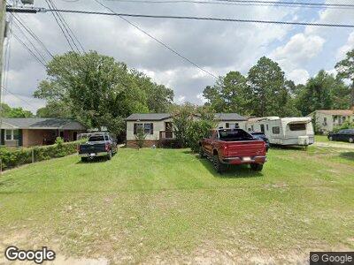
1112 Courtney Dr West Columbia, SC 29172
Pine Ridge NeighborhoodEstimated Value: $120,000 - $212,000
3
Beds
2
Baths
1,416
Sq Ft
$110/Sq Ft
Est. Value
About This Home
This home is located at 1112 Courtney Dr, West Columbia, SC 29172 and is currently estimated at $156,042, approximately $110 per square foot. 1112 Courtney Dr is a home located in Lexington County with nearby schools including Herbert A. Wood Elementary School, Pine Ridge Middle School, and Airport High School.
Ownership History
Date
Name
Owned For
Owner Type
Purchase Details
Closed on
Jul 10, 2020
Sold by
Joseph Neale
Bought by
R & I Investment Group Llc
Current Estimated Value
Purchase Details
Closed on
Feb 28, 2013
Sold by
Hardee Kenneth W
Bought by
Joseph Neale
Home Financials for this Owner
Home Financials are based on the most recent Mortgage that was taken out on this home.
Original Mortgage
$25,000
Interest Rate
3.56%
Mortgage Type
Future Advance Clause Open End Mortgage
Create a Home Valuation Report for This Property
The Home Valuation Report is an in-depth analysis detailing your home's value as well as a comparison with similar homes in the area
Home Values in the Area
Average Home Value in this Area
Purchase History
| Date | Buyer | Sale Price | Title Company |
|---|---|---|---|
| R & I Investment Group Llc | $44,000 | None Available | |
| Joseph Neale | $65,000 | -- |
Source: Public Records
Mortgage History
| Date | Status | Borrower | Loan Amount |
|---|---|---|---|
| Previous Owner | Joseph Neale | $25,000 |
Source: Public Records
Tax History Compared to Growth
Tax History
| Year | Tax Paid | Tax Assessment Tax Assessment Total Assessment is a certain percentage of the fair market value that is determined by local assessors to be the total taxable value of land and additions on the property. | Land | Improvement |
|---|---|---|---|---|
| 2024 | $1,219 | $3,528 | $960 | $2,568 |
| 2023 | $1,219 | $3,528 | $960 | $2,568 |
| 2022 | $1,139 | $3,528 | $960 | $2,568 |
| 2020 | $1,051 | $3,390 | $960 | $2,430 |
| 2019 | $983 | $3,136 | $960 | $2,176 |
| 2018 | $974 | $3,136 | $960 | $2,176 |
| 2017 | $960 | $3,136 | $960 | $2,176 |
| 2016 | $302 | $2,090 | $640 | $1,450 |
| 2014 | $256 | $2,200 | $600 | $1,600 |
| 2013 | -- | $1,260 | $830 | $430 |
Source: Public Records
Map
Nearby Homes
- 1114 Courtney Dr
- 635 Pine Ridge Dr
- 1011 Williams Cir
- 224 Adkins Cir
- 1020 Reynord Cir
- 1038 Reynord Cir
- 1935 Leander Dr
- 127 Long Iron Ct
- 128 Long Iron Ct
- 132 Long Iron Ct
- 136 Long Iron Ct
- 140 Long Iron Ct
- 176 Long Iron Ct
- 213 Long Iron Ct
- 180 Long Iron Ct
- 958 Brookfield Dr
- 249 Long Iron Ct
- 1753 E Berry Rd
- 4154 Bachman Rd
- 918 Arborgate Dr