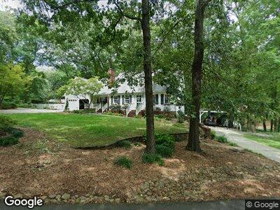
113 Ashley Rd Clemson, SC 29631
Central NeighborhoodEstimated Value: $611,000 - $713,000
3
Beds
4
Baths
2,565
Sq Ft
$258/Sq Ft
Est. Value
About This Home
This home is located at 113 Ashley Rd, Clemson, SC 29631 and is currently estimated at $661,201, approximately $257 per square foot. 113 Ashley Rd is a home located in Pickens County with nearby schools including Clemson Elementary School, R.C. Edwards Middle School, and D.W. Daniel High School.
Ownership History
Date
Name
Owned For
Owner Type
Purchase Details
Closed on
Oct 24, 2022
Sold by
Buckner Michael Earl
Bought by
Counts Bryan and Counts Erika
Current Estimated Value
Home Financials for this Owner
Home Financials are based on the most recent Mortgage that was taken out on this home.
Original Mortgage
$150,000
Outstanding Balance
$146,048
Interest Rate
6.02%
Mortgage Type
New Conventional
Estimated Equity
$465,617
Purchase Details
Closed on
Mar 26, 2010
Sold by
Little Clay A
Bought by
Buckner Michael Earl and Buckner Amity Richards
Home Financials for this Owner
Home Financials are based on the most recent Mortgage that was taken out on this home.
Original Mortgage
$284,187
Interest Rate
4.87%
Mortgage Type
FHA
Purchase Details
Closed on
Mar 2, 2007
Sold by
Little Clay A
Bought by
Little Clay A
Create a Home Valuation Report for This Property
The Home Valuation Report is an in-depth analysis detailing your home's value as well as a comparison with similar homes in the area
Home Values in the Area
Average Home Value in this Area
Purchase History
| Date | Buyer | Sale Price | Title Company |
|---|---|---|---|
| Counts Bryan | $515,000 | -- | |
| Buckner Michael Earl | $294,000 | -- |
Source: Public Records
Mortgage History
| Date | Status | Borrower | Loan Amount |
|---|---|---|---|
| Open | Counts Bryan | $150,000 | |
| Previous Owner | Buckner Michael Earl | $250,000 | |
| Previous Owner | Buckner Michael Earl | $284,187 |
Source: Public Records
Tax History Compared to Growth
Tax History
| Year | Tax Paid | Tax Assessment Tax Assessment Total Assessment is a certain percentage of the fair market value that is determined by local assessors to be the total taxable value of land and additions on the property. | Land | Improvement |
|---|---|---|---|---|
| 2024 | $3,275 | $20,600 | $1,250 | $19,350 |
| 2023 | $3,275 | $20,600 | $1,800 | $18,800 |
| 2022 | $2,021 | $13,390 | $1,800 | $11,590 |
| 2021 | $2,021 | $13,390 | $1,800 | $11,590 |
| 2020 | $1,923 | $13,388 | $1,800 | $11,588 |
| 2019 | $1,974 | $13,390 | $1,800 | $11,590 |
| 2018 | $1,854 | $11,800 | $1,600 | $10,200 |
| 2017 | $1,732 | $11,800 | $1,600 | $10,200 |
| 2015 | $1,798 | $11,620 | $0 | $0 |
| 2008 | -- | $8,800 | $1,120 | $7,680 |
Source: Public Records
Map
Nearby Homes
- 107 Ashley Rd
- 104 Ashley Rd
- 119 Shaftsbury Rd
- 109 Sedgefield Dr
- 109 Laurel Ln
- 109 Pleasant View Dr
- 607 Issaqueena Trail
- 417 Village Walk Ln
- 104 Carolina Dr
- 504 Village Walk Ln
- 510 Squire Cir
- 504 Squire Cir
- 112 Fuller Estate Dr
- 205 Skyview Dr
- 103 Country Walk Cir
- 101 Lancelot Dr
- 109 Vista Dr
- 142 Tabor St
- 300 Downs Blvd
- 101 West Ln Unit 1213