11330 W Spud Island Stockton, CA 95219
Estimated payment $1,396/month
Highlights
- Fishing
- 35.73 Acre Lot
- Recreation Facilities
- River View
- No HOA
- Adjoins Government Land
About This Lot
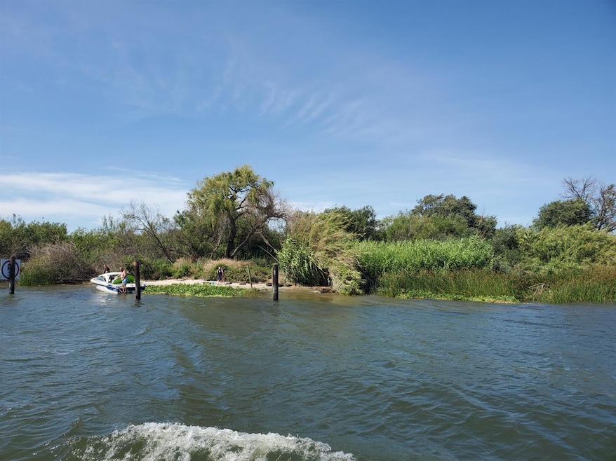
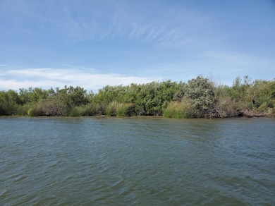
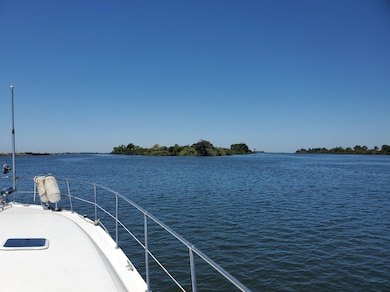
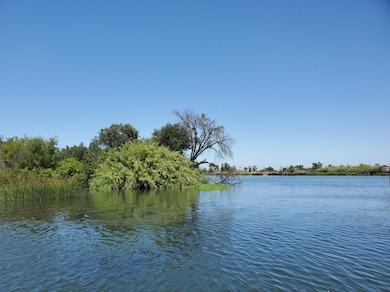
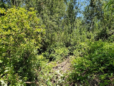
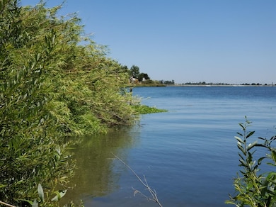
The subject property consists of 35.73+/- Acres located in The San Joaquin Delta, just Seven Miles West of Stockton and is bordered by the Stockton Deep Water Channel, South Spud Island Recreation Area and Twenty-One Mile Cut. The Island is adjacent to recreational developments along the Deep-Water Channel: Weber Point, The Delta Yacht Club, St. Francis Yacht Club, Little Venice Yacht Club and the Stockton Water Ski Club. The Island has become a popular destination for many boaters visiting the Delta. The Camp Site and Picnic area provides enjoyable recreation activities such as Boating, Camping and Fishing. Other uses : Mitigation and Nature Education Center.
Property Details
Property Type
- Land
Est. Annual Taxes
- $218
Lot Details
- 35.73 Acre Lot
- River Front
- Adjoins Government Land
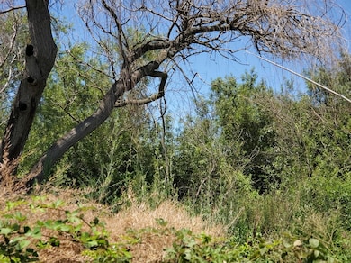
- Brush Vegetation
- Many Trees
- Possible uses of the property include Agricultural, Other, Recreational
- Property is zoned Delta Island Berm, Agricultural,Agricultural/Residential,Recreation,Other
Property Views
- River Views
Listing and Financial Details
- Assessor Parcel Number 129-290-01
Community Details
Overview
- No Home Owners Association
- Pond Year Round
- Stream
Recreation
- Recreation Facilities
- Community Playground
- Fishing
- Hunting
- Shed
Building Details
- Net Lease
Map
Home Values in the Area
Average Home Value in this Area
Tax History
| Year | Tax Paid | Tax Assessment Tax Assessment Total Assessment is a certain percentage of the fair market value that is determined by local assessors to be the total taxable value of land and additions on the property. | Land | Improvement |
|---|---|---|---|---|
| 2024 | $218 | $163,354 | $161,685 | $1,669 |
| 2023 | $2,015 | $160,152 | $158,515 | $1,637 |
| 2022 | $394 | $157,012 | $155,407 | $1,605 |
| 2021 | $218 | $153,934 | $152,360 | $1,574 |
| 2020 | $218 | $152,356 | $150,798 | $1,558 |
| 2019 | $218 | $149,370 | $147,842 | $1,528 |
| 2018 | $218 | $146,443 | $144,944 | $1,499 |
| 2017 | $218 | $143,572 | $142,102 | $1,470 |
| 2016 | $218 | $140,757 | $139,316 | $1,441 |
| 2014 | $221 | $135,928 | $134,536 | $1,392 |
Property History
| Date | Event | Price | Change | Sq Ft Price |
|---|---|---|---|---|
| 01/01/2022 01/01/22 | For Sale | -- | -- | -- |
| 01/01/2022 01/01/22 | Off Market | -- | -- | -- |
| 02/06/2021 02/06/21 | For Sale | $247,000 | -- | -- |
Deed History
| Date | Type | Sale Price | Title Company |
|---|---|---|---|
| Gift Deed | -- | -- | |
| Interfamily Deed Transfer | -- | -- | |
| Gift Deed | -- | -- |
Source: MetroList
MLS Number: 221002635
APN: 129-290-01
Disclaimer: Certain information contained herein is derived from information provided by parties other than Homes.com. All information provided is deemed reliable, but is not guaranteed to be accurate and should be independently verified.
![]() IDX information is provided exclusively for personal, non-commercial use, and may not be used for any purpose other than to identify prospective properties consumers may be interested in purchasing. Information is deemed reliable but not guaranteed.
IDX information is provided exclusively for personal, non-commercial use, and may not be used for any purpose other than to identify prospective properties consumers may be interested in purchasing. Information is deemed reliable but not guaranteed.
- 10018 Talung Dr
- 6813 Mount Elbrus Way
- 6819 Mount Elbrus Way
- 7225 Broom Dr
- 7130 Sambucus Way
- 7024 Mauna Loa Way
- 2104 Turnpike Rd
- 6848 Kilamanjaro Way
- 6819 Saint Elias Way
- 6807 Mount Elbrus Way
- 4322 Riverbank Ct
- 6933 Wamasquid Ln
- 5776 Saint Andrews Dr
- 10913 Mikas Pond Way
- 6713 Embarcadero Dr Unit 27
- 6713 Embarcadero Dr Unit 29
- 6669 Embarcadero Dr Unit 10
- 10015 Havencrest Ct
- 5939 Riverbank Cir
- 4219 Fort Donelson Dr
