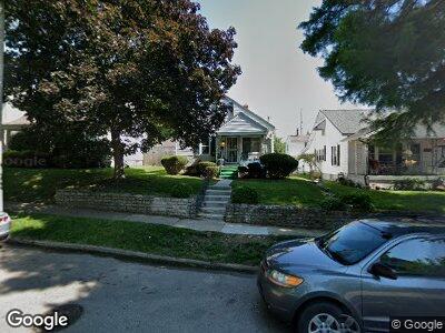
117 Ashwood Ave Dayton, OH 45405
North Riverdale NeighborhoodEstimated Value: $83,300 - $118,000
3
Beds
1
Bath
1,225
Sq Ft
$78/Sq Ft
Est. Value
About This Home
This home is located at 117 Ashwood Ave, Dayton, OH 45405 and is currently estimated at $96,075, approximately $78 per square foot. 117 Ashwood Ave is a home located in Montgomery County with nearby schools including Valerie Elementary School, Horizon Science Academy-Dayton Elementary School, and Imagine Klepinger Road Community School.
Ownership History
Date
Name
Owned For
Owner Type
Purchase Details
Closed on
May 26, 2000
Sold by
Fiore Salvatore R
Bought by
Grubbs Michelle A
Current Estimated Value
Home Financials for this Owner
Home Financials are based on the most recent Mortgage that was taken out on this home.
Original Mortgage
$63,050
Interest Rate
8.18%
Purchase Details
Closed on
Sep 19, 1994
Sold by
Mikalauskas William D
Bought by
Fiore Salvatore R
Create a Home Valuation Report for This Property
The Home Valuation Report is an in-depth analysis detailing your home's value as well as a comparison with similar homes in the area
Home Values in the Area
Average Home Value in this Area
Purchase History
| Date | Buyer | Sale Price | Title Company |
|---|---|---|---|
| Grubbs Michelle A | $65,000 | -- | |
| Fiore Salvatore R | -- | -- |
Source: Public Records
Mortgage History
| Date | Status | Borrower | Loan Amount |
|---|---|---|---|
| Closed | Grubbs Michelle A | $10,901 | |
| Open | Grubbs Michelle A | $89,300 | |
| Closed | Grubbs Michelle A | $63,050 | |
| Closed | Grubbs Michelle A | $1,950 |
Source: Public Records
Tax History Compared to Growth
Tax History
| Year | Tax Paid | Tax Assessment Tax Assessment Total Assessment is a certain percentage of the fair market value that is determined by local assessors to be the total taxable value of land and additions on the property. | Land | Improvement |
|---|---|---|---|---|
| 2024 | -- | $14,280 | $3,840 | $10,440 |
| 2023 | $0 | $14,280 | $3,840 | $10,440 |
| 2022 | $771 | $10,430 | $2,810 | $7,620 |
| 2021 | $767 | $10,430 | $2,810 | $7,620 |
| 2020 | $766 | $10,430 | $2,810 | $7,620 |
| 2019 | $838 | $10,200 | $2,810 | $7,390 |
| 2018 | $839 | $10,200 | $2,810 | $7,390 |
| 2017 | $833 | $10,200 | $2,810 | $7,390 |
| 2016 | $983 | $11,550 | $2,810 | $8,740 |
| 2015 | $931 | $11,550 | $2,810 | $8,740 |
| 2014 | $931 | $11,550 | $2,810 | $8,740 |
| 2012 | -- | $16,260 | $4,200 | $12,060 |
Source: Public Records
Map
Nearby Homes
- 200 E Siebenthaler Ave
- 205 E Siebenthaler Ave
- 201 Ashwood Ave
- 226 Ashwood Ave
- 128 E Bruce Ave
- 121 Knecht Dr
- 325 Ryburn Ave Unit 319-325
- 3836 Merrimac Ave
- 433 Sandhurst Dr
- 3851 Merrimac Ave
- 43 Fer Don Rd
- 25 Redwood Ave
- 30 W Siebenthaler Ave
- 56 Fernwood Ave Unit A,B,C,D
- 52 Fernwood Ave
- 411 Ryburn Ave
- 404 Wampler Ave
- 3851 Carroll Ave
- 105 W Siebenthaler Ave
- 49 Pointview Ave