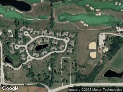
117 Eagles Cove Cir North Prairie, WI 53153
Estimated Value: $639,398 - $659,000
3
Beds
3
Baths
3,117
Sq Ft
$209/Sq Ft
Est. Value
About This Home
This home is located at 117 Eagles Cove Cir, North Prairie, WI 53153 and is currently estimated at $652,100, approximately $209 per square foot. 117 Eagles Cove Cir is a home located in Waukesha County with nearby schools including Prairie View Elementary School, Park View Middle School, and Mukwonago High School.
Ownership History
Date
Name
Owned For
Owner Type
Purchase Details
Closed on
Jan 19, 2024
Sold by
Hilts Thomas and Hilts Linda
Bought by
Thomas D And Linda K Hilts Revocable Trust
Current Estimated Value
Purchase Details
Closed on
Jul 29, 2020
Sold by
Wagner David C and Wagner Stephanie L
Bought by
Hilts Thomas and Hilts Linda
Home Financials for this Owner
Home Financials are based on the most recent Mortgage that was taken out on this home.
Original Mortgage
$353,250
Interest Rate
3%
Mortgage Type
New Conventional
Purchase Details
Closed on
Jul 15, 2016
Sold by
North Prairie Eagles Cove Llc
Bought by
Wagner David C and Wagner Stephanie L
Home Financials for this Owner
Home Financials are based on the most recent Mortgage that was taken out on this home.
Original Mortgage
$315,000
Interest Rate
3.54%
Mortgage Type
New Conventional
Create a Home Valuation Report for This Property
The Home Valuation Report is an in-depth analysis detailing your home's value as well as a comparison with similar homes in the area
Home Values in the Area
Average Home Value in this Area
Purchase History
| Date | Buyer | Sale Price | Title Company |
|---|---|---|---|
| Thomas D And Linda K Hilts Revocable Trust | -- | None Listed On Document | |
| Hilts Thomas | $471,000 | Frontier Title | |
| Wagner David C | $350,000 | None Available |
Source: Public Records
Mortgage History
| Date | Status | Borrower | Loan Amount |
|---|---|---|---|
| Previous Owner | Hilts Thomas | $353,250 | |
| Previous Owner | Wagner David C | $355,300 | |
| Previous Owner | Wagner David C | $315,000 |
Source: Public Records
Tax History Compared to Growth
Tax History
| Year | Tax Paid | Tax Assessment Tax Assessment Total Assessment is a certain percentage of the fair market value that is determined by local assessors to be the total taxable value of land and additions on the property. | Land | Improvement |
|---|---|---|---|---|
| 2024 | $5,009 | $465,600 | $55,000 | $410,600 |
| 2023 | $5,177 | $465,600 | $55,000 | $410,600 |
| 2022 | $5,006 | $465,600 | $55,000 | $410,600 |
| 2021 | $5,261 | $465,600 | $55,000 | $410,600 |
| 2020 | $5,067 | $334,600 | $25,000 | $309,600 |
| 2019 | $4,679 | $334,600 | $25,000 | $309,600 |
| 2018 | $4,457 | $334,600 | $25,000 | $309,600 |
| 2017 | $5,389 | $334,600 | $25,000 | $309,600 |
Source: Public Records
Map
Nearby Homes
- 209 Eagles Cove Cir
- 200 Eagles Cove Cir
- 140 Chestnut Way
- W335S5022 Fox Hollow Dr
- 401 Morrissey Dr
- S72W32479 Sandie Ct
- W330S8380 Isabelle Dr
- W315S7605 Lakecrest Dr
- W336S8586 County Rd E
- S50W30814 Old Village Rd
- W324S3711 County Rd E
- S79W31435 Green Meadows Dr
- W314S4260 Wisconsin 83
- W327S3605 Mesa Trail
- W304S6768 County Road I
- S37W31628 Bennett Rd
- Lt3 W Talbots Woods Dr
- Lt1 W Talbot's Woods Dr
- Pcl0 E Main St
- W336S9603 Red Brae Dr
