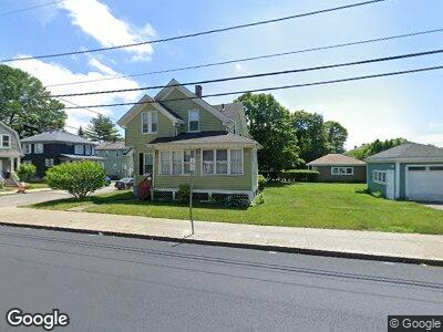
1183 President Ave Fall River, MA 02720
Highlands-Fall River NeighborhoodEstimated Value: $410,000 - $453,000
3
Beds
1
Bath
1,285
Sq Ft
$335/Sq Ft
Est. Value
About This Home
This home is located at 1183 President Ave, Fall River, MA 02720 and is currently estimated at $429,836, approximately $334 per square foot. 1183 President Ave is a home located in Bristol County with nearby schools including Spencer Borden Elementary School, Morton Middle School, and B M C Durfee High School.
Ownership History
Date
Name
Owned For
Owner Type
Purchase Details
Closed on
Oct 15, 2012
Sold by
Garrity Thomas J and Garrity Theresa C
Bought by
Garrity Thomas J and Garrity Theresa C
Current Estimated Value
Purchase Details
Closed on
Jul 23, 1971
Bought by
Garrity Thomas J and Garrity Theresa C
Create a Home Valuation Report for This Property
The Home Valuation Report is an in-depth analysis detailing your home's value as well as a comparison with similar homes in the area
Home Values in the Area
Average Home Value in this Area
Purchase History
| Date | Buyer | Sale Price | Title Company |
|---|---|---|---|
| Garrity Thomas J | -- | -- | |
| Garrity Thomas J | $17,500 | -- | |
| Garrity Thomas J | -- | -- |
Source: Public Records
Mortgage History
| Date | Status | Borrower | Loan Amount |
|---|---|---|---|
| Open | Carmichael Shayn | $299,500 | |
| Closed | Carmichael Shayn | $299,500 | |
| Closed | Oliveira Ronald | $300,000 | |
| Previous Owner | Garrity Theresa | $10,000 | |
| Previous Owner | Garrity Theresa C | $10,000 |
Source: Public Records
Tax History Compared to Growth
Tax History
| Year | Tax Paid | Tax Assessment Tax Assessment Total Assessment is a certain percentage of the fair market value that is determined by local assessors to be the total taxable value of land and additions on the property. | Land | Improvement |
|---|---|---|---|---|
| 2025 | $3,931 | $343,300 | $141,700 | $201,600 |
| 2024 | $3,454 | $300,600 | $136,200 | $164,400 |
| 2023 | $3,221 | $262,500 | $117,800 | $144,700 |
| 2022 | $3,007 | $238,300 | $110,100 | $128,200 |
| 2021 | $2,937 | $212,400 | $110,500 | $101,900 |
| 2020 | $3,008 | $208,200 | $110,700 | $97,500 |
| 2019 | $2,982 | $204,500 | $112,400 | $92,100 |
| 2018 | $2,857 | $195,400 | $112,400 | $83,000 |
| 2017 | $2,597 | $185,500 | $103,200 | $82,300 |
| 2016 | $2,470 | $181,200 | $103,200 | $78,000 |
| 2015 | $2,370 | $181,200 | $103,200 | $78,000 |
| 2014 | $2,191 | $174,200 | $96,200 | $78,000 |
Source: Public Records
Map
Nearby Homes
- 1310 President Ave
- 923 Robeson St
- 603 Ray St
- 402 Elsbree St
- 503 Highland Ave
- 654 Highland Ave
- 765 Madison St
- 208 Florence St
- 213 Weetamoe St
- 341 Belmont St
- 52 Underwood St
- 361 Adams Unit Lot 41
- 146 Bullock St
- 131 Stewart St Unit 1A
- 536 N Underwood St
- 18 Pear St
- 379-381 Robeson St
- 936 Locust St
- 787 High St
- 434 Linden St Unit 2