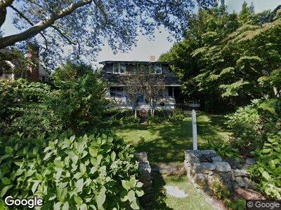
12 Saunders Rd Saunderstown, RI 02874
Saunderstown NeighborhoodEstimated Value: $1,337,565 - $1,563,000
5
Beds
2
Baths
1,751
Sq Ft
$816/Sq Ft
Est. Value
About This Home
This home is located at 12 Saunders Rd, Saunderstown, RI 02874 and is currently estimated at $1,428,141, approximately $815 per square foot. 12 Saunders Rd is a home with nearby schools including Hamilton Elementary School, Wickford Middle School, and North Kingstown Sr. High School.
Ownership History
Date
Name
Owned For
Owner Type
Purchase Details
Closed on
Sep 27, 2024
Sold by
Breslin Robert H and Breslin Jennifer C
Bought by
Louisa R H Lafarge T R and Louisa Lafarge
Current Estimated Value
Purchase Details
Closed on
Sep 15, 1995
Sold by
Fulweiler John K and Fulweiler Megan
Bought by
Claypool William D and Claypool Cissy
Home Financials for this Owner
Home Financials are based on the most recent Mortgage that was taken out on this home.
Original Mortgage
$120,000
Interest Rate
7.81%
Create a Home Valuation Report for This Property
The Home Valuation Report is an in-depth analysis detailing your home's value as well as a comparison with similar homes in the area
Home Values in the Area
Average Home Value in this Area
Purchase History
| Date | Buyer | Sale Price | Title Company |
|---|---|---|---|
| Louisa R H Lafarge T R | $1,410,000 | None Available | |
| Claypool William D | $240,000 | -- |
Source: Public Records
Mortgage History
| Date | Status | Borrower | Loan Amount |
|---|---|---|---|
| Previous Owner | Breslin Jennifer C | $350,000 | |
| Previous Owner | Claypool William D | $377,000 | |
| Previous Owner | Claypool William D | $384,000 | |
| Previous Owner | Claypool William D | $389,000 | |
| Previous Owner | Claypool William D | $120,000 |
Source: Public Records
Tax History Compared to Growth
Tax History
| Year | Tax Paid | Tax Assessment Tax Assessment Total Assessment is a certain percentage of the fair market value that is determined by local assessors to be the total taxable value of land and additions on the property. | Land | Improvement |
|---|---|---|---|---|
| 2024 | $9,262 | $645,900 | $394,700 | $251,200 |
| 2023 | $9,262 | $645,900 | $394,700 | $251,200 |
| 2022 | $9,081 | $645,900 | $394,700 | $251,200 |
| 2021 | $7,413 | $423,600 | $223,700 | $199,900 |
| 2020 | $7,239 | $423,600 | $223,700 | $199,900 |
| 2019 | $7,239 | $423,600 | $223,700 | $199,900 |
| 2018 | $7,008 | $369,400 | $213,800 | $155,600 |
| 2017 | $6,867 | $369,400 | $213,800 | $155,600 |
| 2016 | $6,671 | $369,400 | $213,800 | $155,600 |
| 2015 | $6,948 | $360,000 | $213,800 | $146,200 |
| 2014 | $6,808 | $360,000 | $213,800 | $146,200 |
Source: Public Records
Map
Nearby Homes
- 100 Rose Hill Rd
- 365 Snuff Mill Rd
- 6 Meadowrue Trail
- 82 Joseph Ct Unit 7
- 29 Wake Robin Trail
- 23 Abalone Rd
- 5 Calypso Dr
- 76 What Cheer Rd
- 32 Tanglewood Trail
- 26 King Philip Rd
- 4 Tanglewood Trail
- 9 Lakeside Dr
- 2424 Tower Hill Rd
- 46 Hillside Ct
- 2180 Tower Hill Rd
- 71 Mast St
- 3 Allagash Trail
- 45 Beach Ave
- 142 Colonel John Gardner Rd
- 63 Isabelle Dr