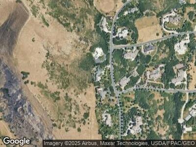
1201 N Oak Forest Rd Salt Lake City, UT 84103
Capitol Hill NeighborhoodEstimated Value: $4,405,000 - $4,641,000
3
Beds
5
Baths
7,239
Sq Ft
$627/Sq Ft
Est. Value
About This Home
This home is located at 1201 N Oak Forest Rd, Salt Lake City, UT 84103 and is currently estimated at $4,539,464, approximately $627 per square foot. 1201 N Oak Forest Rd is a home located in Salt Lake County with nearby schools including Washington School, West High, and Open Classroom.
Ownership History
Date
Name
Owned For
Owner Type
Purchase Details
Closed on
Jun 5, 2024
Sold by
Bott Kevin L
Bought by
Bott Kevin L and Bott Tessa
Current Estimated Value
Purchase Details
Closed on
May 16, 2024
Sold by
Linda Sue Jacob St Clair Revocable Trust and St Clair Linda Sue Jacob
Bought by
Bott Kevin L
Purchase Details
Closed on
Aug 27, 2009
Sold by
Blain Linda S and Clair Linda Sue Jacob St
Bought by
Clair Linda Sue Jacob St and The Linda Sue Jacob St Clair Revocable T
Purchase Details
Closed on
Aug 14, 2009
Sold by
St Clair Lester
Bought by
Blain Linda S and St Clair Linda Sue Jacob
Purchase Details
Closed on
Jul 27, 2009
Sold by
St Clair Lester
Bought by
Blain Linda S and St Clair Linda Sue Jacob
Purchase Details
Closed on
Sep 8, 2005
Sold by
Blain Linda S and St Clair Lester
Bought by
Blain Linda S and St Clair Lester
Purchase Details
Closed on
May 21, 2004
Sold by
Dahlin Joellin W
Bought by
Blain Linda S and Stclair Lester
Create a Home Valuation Report for This Property
The Home Valuation Report is an in-depth analysis detailing your home's value as well as a comparison with similar homes in the area
Home Values in the Area
Average Home Value in this Area
Purchase History
| Date | Buyer | Sale Price | Title Company |
|---|---|---|---|
| Bott Kevin L | -- | None Listed On Document | |
| Bott Kevin L | -- | North Star Title Insurance Age | |
| Clair Linda Sue Jacob St | -- | None Available | |
| Blain Linda S | -- | None Available | |
| Blain Linda S | -- | None Available | |
| Blain Linda S | -- | None Available | |
| Blain Linda S | -- | Merrill Title |
Source: Public Records
Mortgage History
| Date | Status | Borrower | Loan Amount |
|---|---|---|---|
| Open | Bott Kevin L | $3,360,000 |
Source: Public Records
Tax History Compared to Growth
Tax History
| Year | Tax Paid | Tax Assessment Tax Assessment Total Assessment is a certain percentage of the fair market value that is determined by local assessors to be the total taxable value of land and additions on the property. | Land | Improvement |
|---|---|---|---|---|
| 2023 | $22,249 | $3,914,590 | $1,057,890 | $2,856,700 |
| 2022 | $24,726 | $4,092,890 | $1,036,790 | $3,056,100 |
| 2021 | $21,263 | $3,207,800 | $722,100 | $2,485,700 |
| 2020 | $19,954 | $2,853,200 | $711,100 | $2,142,100 |
| 2019 | $21,291 | $2,867,990 | $682,790 | $2,185,200 |
| 2018 | $22,972 | $3,019,090 | $682,790 | $2,336,300 |
| 2017 | $22,344 | $2,741,290 | $682,790 | $2,058,500 |
| 2016 | $18,632 | $2,136,690 | $696,090 | $1,440,600 |
| 2015 | $24,890 | $2,719,090 | $775,690 | $1,943,400 |
| 2014 | $23,961 | $2,596,590 | $740,790 | $1,855,800 |
Source: Public Records
Map
Nearby Homes
- 67 E Dorchester Dr
- 819 N Juniperpoint Dr
- 804 N Juniperpoint Dr
- 545 E 16th Ave
- 692 Cortez St
- 381 E 11th Ave
- 579 E 13th Ave
- 631 N Darwin St Unit 10
- 242 Reed Ave N
- 1348 E Perrys Hollow Rd N
- 664 N East Capitol St
- 656 N East Capitol St
- 1144 N Twickenham Dr W Unit 137
- 672 N 200 W
- 135 W 600 N
- 45 E 500 N
- 65 E 500 N
- 723 N 300 W Unit 11
- 723 N 300 W Unit 1
- 650 N 300 W Unit 118
