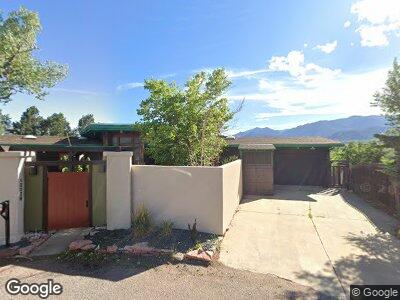
1202 W High Point Ln Colorado Springs, CO 80904
The Mesa NeighborhoodEstimated Value: $640,000 - $680,000
4
Beds
3
Baths
1,807
Sq Ft
$361/Sq Ft
Est. Value
About This Home
This home is located at 1202 W High Point Ln, Colorado Springs, CO 80904 and is currently estimated at $652,092, approximately $360 per square foot. 1202 W High Point Ln is a home located in El Paso County with nearby schools including Bristol Elementary, School of the Arts and STEM, Holmes Middle School, and Coronado High School.
Ownership History
Date
Name
Owned For
Owner Type
Purchase Details
Closed on
Feb 5, 2025
Sold by
Moyers Robert Matthew
Bought by
Voorhies Jessica
Current Estimated Value
Home Financials for this Owner
Home Financials are based on the most recent Mortgage that was taken out on this home.
Original Mortgage
$576,900
Outstanding Balance
$576,900
Interest Rate
6.85%
Mortgage Type
New Conventional
Estimated Equity
$75,192
Purchase Details
Closed on
Nov 17, 1988
Bought by
Moyers Robert M
Create a Home Valuation Report for This Property
The Home Valuation Report is an in-depth analysis detailing your home's value as well as a comparison with similar homes in the area
Home Values in the Area
Average Home Value in this Area
Purchase History
| Date | Buyer | Sale Price | Title Company |
|---|---|---|---|
| Voorhies Jessica | $641,000 | Stewart Title | |
| Moyers Robert M | -- | -- |
Source: Public Records
Mortgage History
| Date | Status | Borrower | Loan Amount |
|---|---|---|---|
| Open | Voorhies Jessica | $576,900 | |
| Previous Owner | Moyers Robert M | $120,000 | |
| Previous Owner | Moyers Robert M | $24,000 |
Source: Public Records
Tax History Compared to Growth
Tax History
| Year | Tax Paid | Tax Assessment Tax Assessment Total Assessment is a certain percentage of the fair market value that is determined by local assessors to be the total taxable value of land and additions on the property. | Land | Improvement |
|---|---|---|---|---|
| 2024 | $1,887 | $47,280 | $12,190 | $35,090 |
| 2023 | $1,887 | $47,280 | $12,190 | $35,090 |
| 2022 | $1,850 | $40,010 | $11,520 | $28,490 |
| 2021 | $2,007 | $41,160 | $11,850 | $29,310 |
| 2020 | $1,900 | $35,150 | $9,850 | $25,300 |
| 2019 | $1,890 | $35,150 | $9,850 | $25,300 |
| 2018 | $1,778 | $31,430 | $7,370 | $24,060 |
| 2017 | $1,684 | $31,430 | $7,370 | $24,060 |
| 2016 | $1,335 | $30,980 | $7,760 | $23,220 |
| 2015 | $1,329 | $30,980 | $7,760 | $23,220 |
| 2014 | $1,710 | $28,420 | $7,760 | $20,660 |
Source: Public Records
Map
Nearby Homes
- 968 Terrace Cir
- 976 Uintah Bluffs Place
- 1426 N Chestnut St
- 918 N Spruce St
- 549 W Dale St Unit 569
- 565 W Dale St
- 1728 Armstrong Ave
- 931 N 18th St
- 1355 Talley Cir
- 1345 Talley Cir
- 610 N Tower St
- 411 Olive St
- 590 Observatory Dr Unit 5B
- 1215 N 19th St
- 738 Harrison Place
- 1025 N 19th St
- 315 W Monument St
- 660 Pony Ln