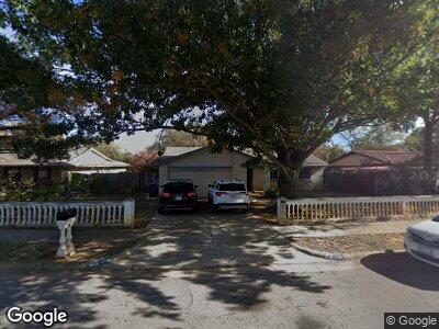
1206 Denton Dr Euless, TX 76039
Estimated Value: $268,000 - $330,000
3
Beds
2
Baths
1,421
Sq Ft
$210/Sq Ft
Est. Value
About This Home
This home is located at 1206 Denton Dr, Euless, TX 76039 and is currently estimated at $298,839, approximately $210 per square foot. 1206 Denton Dr is a home located in Tarrant County with nearby schools including North Euless Elementary School, Euless J High School, and Trinity High School.
Ownership History
Date
Name
Owned For
Owner Type
Purchase Details
Closed on
Oct 13, 1999
Sold by
Kantai Toutai
Bought by
Vaai Laiatea L and Vaai Emelie T
Current Estimated Value
Purchase Details
Closed on
Oct 14, 1998
Sold by
Hola Fulilange and Hola Malia C
Bought by
Vaai Laiatea L and Vaai Emelie T
Purchase Details
Closed on
Nov 30, 1994
Sold by
Revocable Living Trust Agreement Of Rona
Bought by
Vaai Lasalosi
Home Financials for this Owner
Home Financials are based on the most recent Mortgage that was taken out on this home.
Original Mortgage
$63,650
Interest Rate
8.8%
Create a Home Valuation Report for This Property
The Home Valuation Report is an in-depth analysis detailing your home's value as well as a comparison with similar homes in the area
Home Values in the Area
Average Home Value in this Area
Purchase History
| Date | Buyer | Sale Price | Title Company |
|---|---|---|---|
| Vaai Laiatea L | -- | -- | |
| Vaai Laiatea L | -- | -- | |
| Vaai Lasalosi | -- | American Title Company |
Source: Public Records
Mortgage History
| Date | Status | Borrower | Loan Amount |
|---|---|---|---|
| Open | Vaai Lasalosi | $89,250 | |
| Closed | Vaai Lasalosi | $97,000 | |
| Previous Owner | Vaai Lasalosi | $63,000 | |
| Previous Owner | Vaai Lasalosi | $63,650 |
Source: Public Records
Tax History Compared to Growth
Tax History
| Year | Tax Paid | Tax Assessment Tax Assessment Total Assessment is a certain percentage of the fair market value that is determined by local assessors to be the total taxable value of land and additions on the property. | Land | Improvement |
|---|---|---|---|---|
| 2024 | $3,993 | $241,316 | $65,000 | $176,316 |
| 2023 | $3,993 | $212,428 | $40,000 | $172,428 |
| 2022 | $4,157 | $193,482 | $40,000 | $153,482 |
| 2021 | $4,257 | $189,296 | $40,000 | $149,296 |
| 2020 | $4,651 | $204,787 | $40,000 | $164,787 |
| 2019 | $4,503 | $193,243 | $40,000 | $153,243 |
| 2018 | $4,252 | $182,471 | $40,000 | $142,471 |
| 2017 | $4,058 | $168,721 | $25,000 | $143,721 |
| 2016 | $3,398 | $141,266 | $25,000 | $116,266 |
| 2015 | $2,973 | $119,700 | $16,000 | $103,700 |
| 2014 | $2,973 | $119,700 | $16,000 | $103,700 |
Source: Public Records
Map
Nearby Homes
- 306 Fair Oaks Blvd
- 309 Shelmar Dr
- 1315 Aransas Dr
- 1018 Harris Dr
- 208 Shelmar Dr
- 1213 Glenn Dr
- 507 Brownstone St
- 601 Shelmar Dr
- 108 Walnut Way
- 1215 Crane Dr
- 1013 Crane Dr
- 703 Johns Dr
- 103 W Ash Ln
- 906 Aransas Dr
- 616 Donley Dr
- 802 Chipwood Ct
- 907 Waterford Way
- 804 Milam Dr
- 207 E Harwood Rd Unit 39
- 614 Dogwood Cir
