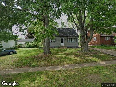
1207 Sutherland Ave Akron, OH 44314
Kenmore NeighborhoodEstimated Value: $68,372 - $145,000
3
Beds
1
Bath
985
Sq Ft
$124/Sq Ft
Est. Value
About This Home
This home is located at 1207 Sutherland Ave, Akron, OH 44314 and is currently estimated at $121,843, approximately $123 per square foot. 1207 Sutherland Ave is a home located in Summit County with nearby schools including Imagine Akron Academy and Sam Salem Community Learning Center.
Ownership History
Date
Name
Owned For
Owner Type
Purchase Details
Closed on
Dec 17, 2020
Sold by
Thomas James C and Estat Of Carol V Blair
Bought by
Sfr3 Aic Llc
Current Estimated Value
Purchase Details
Closed on
Jul 24, 2020
Sold by
Blair Richard D
Bought by
Blair Carol V and Thomas James C
Purchase Details
Closed on
Jul 7, 2020
Sold by
Blair Richard D
Bought by
Blair Carol V and Thomas James C
Create a Home Valuation Report for This Property
The Home Valuation Report is an in-depth analysis detailing your home's value as well as a comparison with similar homes in the area
Home Values in the Area
Average Home Value in this Area
Purchase History
| Date | Buyer | Sale Price | Title Company |
|---|---|---|---|
| Sfr3 Aic Llc | $31,500 | None Available | |
| Blair Carol V | -- | -- | |
| Blair Carol V | -- | None Available |
Source: Public Records
Tax History Compared to Growth
Tax History
| Year | Tax Paid | Tax Assessment Tax Assessment Total Assessment is a certain percentage of the fair market value that is determined by local assessors to be the total taxable value of land and additions on the property. | Land | Improvement |
|---|---|---|---|---|
| 2025 | $2,027 | $36,943 | $9,688 | $27,255 |
| 2024 | $2,027 | $36,943 | $9,688 | $27,255 |
| 2023 | $2,027 | $36,943 | $9,688 | $27,255 |
| 2022 | $1,708 | $23,104 | $6,017 | $17,087 |
| 2021 | $1,810 | $24,606 | $6,017 | $18,589 |
| 2020 | $1,181 | $24,610 | $6,020 | $18,590 |
| 2019 | $1,254 | $24,190 | $5,840 | $18,350 |
| 2018 | $1,239 | $24,190 | $5,840 | $18,350 |
| 2017 | $1,179 | $24,190 | $5,840 | $18,350 |
| 2016 | $1,180 | $24,190 | $5,840 | $18,350 |
| 2015 | $1,179 | $24,190 | $5,840 | $18,350 |
| 2014 | $1,170 | $24,190 | $5,840 | $18,350 |
| 2013 | $970 | $21,610 | $5,840 | $15,770 |
Source: Public Records
Map
Nearby Homes
- 1165 Stanwood Ave
- 2983 Saralee Ave
- 1143 Stanwood Ave
- 1235 Sevilla Ave
- 1075 Winston St
- 1078 Breckenridge St
- 1292 Tampa Ave
- 985 Winston St
- 971 Sutherland Ave
- 1147 Mcintosh Ave
- 1274 Welsh Ave
- 859 Sutherland Ave
- 292 E State St
- 517 E State St
- 801 E Paige Ave
- 2933 Unclmorse Ave
- 52 Norwood St
- 76 Hazelwood Ave
- V/L Coventry Rd
- 2389 29th St SW