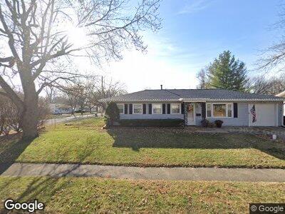
121 Meadowbrook Dr Bloomington, IL 61701
Estimated Value: $167,700 - $174,000
3
Beds
1
Bath
1,155
Sq Ft
$148/Sq Ft
Est. Value
About This Home
This home is located at 121 Meadowbrook Dr, Bloomington, IL 61701 and is currently estimated at $170,925, approximately $147 per square foot. 121 Meadowbrook Dr is a home located in McLean County with nearby schools including Oakland Elementary School, Bloomington Junior High School, and Bloomington High School.
Ownership History
Date
Name
Owned For
Owner Type
Purchase Details
Closed on
Oct 22, 2010
Sold by
Vernon Tim and Vernon Magan
Bought by
Lipic Robert J and Lipic Ruth Ann
Current Estimated Value
Home Financials for this Owner
Home Financials are based on the most recent Mortgage that was taken out on this home.
Original Mortgage
$82,800
Interest Rate
4.36%
Purchase Details
Closed on
Mar 22, 2005
Sold by
Bandy Stella Katherine
Bought by
Vernon Tim
Home Financials for this Owner
Home Financials are based on the most recent Mortgage that was taken out on this home.
Original Mortgage
$10,500
Interest Rate
5.61%
Create a Home Valuation Report for This Property
The Home Valuation Report is an in-depth analysis detailing your home's value as well as a comparison with similar homes in the area
Home Values in the Area
Average Home Value in this Area
Purchase History
| Date | Buyer | Sale Price | Title Company |
|---|---|---|---|
| Lipic Robert J | $103,500 | Frontier Title | |
| Vernon Tim | -- | None Available |
Source: Public Records
Mortgage History
| Date | Status | Borrower | Loan Amount |
|---|---|---|---|
| Closed | Lipic Robert J | $82,800 | |
| Previous Owner | Vernon Tim | $10,500 |
Source: Public Records
Tax History Compared to Growth
Tax History
| Year | Tax Paid | Tax Assessment Tax Assessment Total Assessment is a certain percentage of the fair market value that is determined by local assessors to be the total taxable value of land and additions on the property. | Land | Improvement |
|---|---|---|---|---|
| 2022 | $3,741 | $44,014 | $11,064 | $32,950 |
| 2021 | $3,467 | $40,790 | $10,254 | $30,536 |
| 2020 | $3,370 | $39,756 | $9,994 | $29,762 |
| 2019 | $3,303 | $39,080 | $9,824 | $29,256 |
| 2018 | $3,257 | $38,693 | $9,727 | $28,966 |
| 2017 | $3,163 | $37,566 | $9,444 | $28,122 |
| 2016 | $3,157 | $37,566 | $9,444 | $28,122 |
| 2015 | $3,107 | $37,069 | $9,319 | $27,750 |
| 2014 | $2,961 | $36,490 | $9,319 | $27,171 |
| 2013 | -- | $35,428 | $9,048 | $26,380 |
Source: Public Records
Map
Nearby Homes
- 1811 E Lincoln St
- 105 Meadowbrook Dr
- 1835 E Lincoln St
- 1806 E Lafayette St
- 11 Ryan Dr
- 706 Vale St
- 5213 Castlebar Dr
- 5206 Castlebar Dr
- 5212 Castlebar Dr
- 5304 Castlebar Dr
- 113 Maizefield Ave
- 1614 E Oakland Ave
- 515 Vale St
- 4 Willedrob Rd Unit 5
- 4 Willedrob Rd Unit 3
- 2110 E Oakland Ave
- 1207 Bunn St
- 1210 E Oakland Ave
- 810 E Bissell St
- 10 Willedrob Rd Unit 7