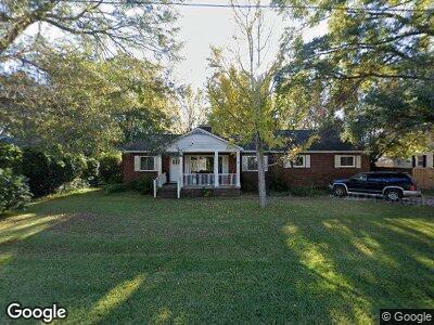
1215 Eastwood Ave Hanahan, SC 29410
Estimated Value: $372,569 - $442,000
4
Beds
2
Baths
1,923
Sq Ft
$210/Sq Ft
Est. Value
About This Home
This home is located at 1215 Eastwood Ave, Hanahan, SC 29410 and is currently estimated at $403,892, approximately $210 per square foot. 1215 Eastwood Ave is a home located in Berkeley County with nearby schools including Hanahan Elementary School, Hanahan Middle School, and Hanahan High School.
Ownership History
Date
Name
Owned For
Owner Type
Purchase Details
Closed on
Jun 6, 2024
Sold by
Zerbst Chris A and Zerbst Kimberly C
Bought by
1215 Eastwood Ave Llc
Current Estimated Value
Purchase Details
Closed on
May 6, 2016
Sold by
Schuster Charles E
Bought by
Zerbst Chris A and Zerbst Kimberly C
Home Financials for this Owner
Home Financials are based on the most recent Mortgage that was taken out on this home.
Original Mortgage
$124,500
Interest Rate
2.88%
Mortgage Type
Future Advance Clause Open End Mortgage
Purchase Details
Closed on
Mar 18, 2005
Sold by
Schuster Lillie E
Bought by
Schuster Charles E
Create a Home Valuation Report for This Property
The Home Valuation Report is an in-depth analysis detailing your home's value as well as a comparison with similar homes in the area
Home Values in the Area
Average Home Value in this Area
Purchase History
| Date | Buyer | Sale Price | Title Company |
|---|---|---|---|
| 1215 Eastwood Ave Llc | -- | None Listed On Document | |
| Zerbst Chris A | $166,000 | -- | |
| Schuster Charles E | -- | -- |
Source: Public Records
Mortgage History
| Date | Status | Borrower | Loan Amount |
|---|---|---|---|
| Previous Owner | Zerbst Chris A | $124,500 | |
| Previous Owner | Schuster Charles E | $50,000 | |
| Previous Owner | Schuster Charles E | $69,348 |
Source: Public Records
Tax History Compared to Growth
Tax History
| Year | Tax Paid | Tax Assessment Tax Assessment Total Assessment is a certain percentage of the fair market value that is determined by local assessors to be the total taxable value of land and additions on the property. | Land | Improvement |
|---|---|---|---|---|
| 2024 | $3,850 | $216,097 | $54,889 | $161,208 |
| 2023 | $3,850 | $12,965 | $3,293 | $9,672 |
| 2022 | $3,488 | $11,275 | $2,256 | $9,019 |
| 2021 | $3,555 | $11,280 | $2,256 | $9,019 |
| 2020 | $3,456 | $11,275 | $2,256 | $9,019 |
| 2019 | $3,496 | $11,275 | $2,256 | $9,019 |
| 2018 | $3,230 | $9,804 | $1,500 | $8,304 |
| 2017 | $3,209 | $9,804 | $1,500 | $8,304 |
| 2016 | $1,014 | $10,520 | $1,500 | $9,020 |
| 2015 | $894 | $6,470 | $1,000 | $5,470 |
| 2014 | $869 | $6,470 | $1,000 | $5,470 |
| 2013 | -- | $6,470 | $1,000 | $5,470 |
Source: Public Records
Map
Nearby Homes
- 1211 Eastwood Ave
- 1216 Eastwood Ave
- 1226 Pickens St
- 1204 Vienna Woods Rd
- 1264 Fort Dr
- 6260 Brandt St Unit 4D
- 6305 Brandt St
- 1910 Tropicana Rd Unit 9D
- 1910 Tropicana Rd Unit 9B
- 6250 Brandt St Unit 51D
- 1902 Morgan Ave
- 6244 Lucille Dr Unit B
- 1215 Redeemer Dr
- 1258 Redeemer Dr
- 6255 Lucille Dr Unit 19C
- 6279 Lucille Dr Unit 22B
- 1228 Brookside Dr
- 1113 Smithfield Place
- 6275 Rolling Fork Rd Unit C
- 6024 Meadowcliff Ave