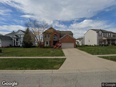
1220 Terrington Dr Brunswick, OH 44212
Estimated Value: $398,317 - $418,000
4
Beds
3
Baths
2,015
Sq Ft
$202/Sq Ft
Est. Value
About This Home
This home is located at 1220 Terrington Dr, Brunswick, OH 44212 and is currently estimated at $407,579, approximately $202 per square foot. 1220 Terrington Dr is a home located in Medina County with nearby schools including Applewood Elementary School, Willets Middle School, and Brunswick High School.
Ownership History
Date
Name
Owned For
Owner Type
Purchase Details
Closed on
May 10, 2004
Sold by
Pulte Homes Of Ohio Llc
Bought by
Riedthaler Sharon M and Shandor Jeffrey A
Current Estimated Value
Home Financials for this Owner
Home Financials are based on the most recent Mortgage that was taken out on this home.
Original Mortgage
$181,668
Interest Rate
5.5%
Mortgage Type
Purchase Money Mortgage
Create a Home Valuation Report for This Property
The Home Valuation Report is an in-depth analysis detailing your home's value as well as a comparison with similar homes in the area
Home Values in the Area
Average Home Value in this Area
Purchase History
| Date | Buyer | Sale Price | Title Company |
|---|---|---|---|
| Riedthaler Sharon M | $227,100 | Pulte Title Agency Llc |
Source: Public Records
Mortgage History
| Date | Status | Borrower | Loan Amount |
|---|---|---|---|
| Open | Shandor Sharon M | $162,036 | |
| Closed | Riedthaler Sharon M | $181,668 | |
| Closed | Riedthaler Sharon M | $22,709 |
Source: Public Records
Tax History Compared to Growth
Tax History
| Year | Tax Paid | Tax Assessment Tax Assessment Total Assessment is a certain percentage of the fair market value that is determined by local assessors to be the total taxable value of land and additions on the property. | Land | Improvement |
|---|---|---|---|---|
| 2023 | $5,957 | $105,580 | $28,220 | $77,360 |
| 2022 | $5,657 | $105,580 | $28,220 | $77,360 |
| 2021 | $5,023 | $82,480 | $22,050 | $60,430 |
| 2020 | $4,563 | $82,480 | $22,050 | $60,430 |
| 2019 | $4,364 | $77,460 | $22,050 | $55,410 |
| 2018 | $3,975 | $67,770 | $18,140 | $49,630 |
| 2017 | $3,980 | $67,770 | $18,140 | $49,630 |
| 2016 | $3,977 | $67,770 | $18,140 | $49,630 |
| 2015 | $3,674 | $62,750 | $16,800 | $45,950 |
| 2014 | $3,666 | $62,750 | $16,800 | $45,950 |
| 2013 | $3,672 | $62,750 | $16,800 | $45,950 |
Source: Public Records
Map
Nearby Homes
- 0 Terrington Dr Unit 4467162
- 4995 Barlow Dr
- 5171 Kenton Ln
- 5101 Center Rd
- 5035 Center Rd
- 1440 Muirwood Dr
- 4903 Center Rd
- 1022 Woodfield Ln
- 4871 Treeline Dr
- 4847 Treeline Dr
- 5100 Creekside Blvd
- 1447 Spyglass Hill Dr
- 5311 Millcreek Blvd
- 4673 Muirfield Ave
- 712 Northfork Way
- 1523 Garfield Ave
- 5206 Spruce Pointe Ln
- 2100 Pearl Rd
- 0 Pearl Rd Unit 4173749
- 457 Winward Ln