About This Lot
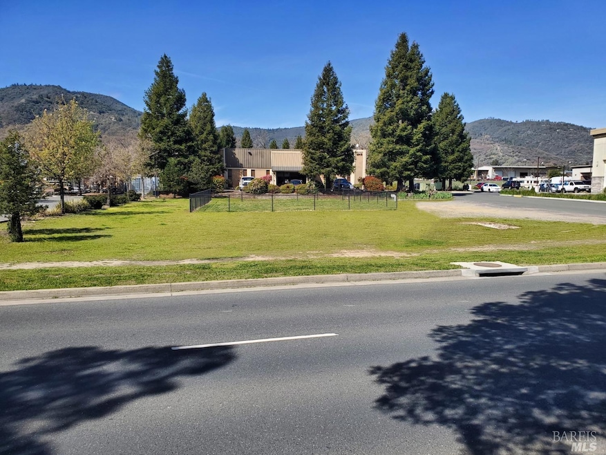
As of March 2025We are pleased to present an unusual opportunity to own land on busy Airport Park Blvd with high visibility. This parcel is located in a high traffic area where Costco, Savings Bank of Mendocino County, Friedman Brothers, Tractor Supply, Wal Mart, Fowler Motors, Food Max, Michaels, Staples, Panda Express are located. There are also other independent business, restaurants and hotels in the neighborhood. Airport Park Blvd is located close to Highway 101 and the Ukiah Municipal Airport. Public and private utilities are available at the street.

Property Details
Property Type
- Land
Est. Annual Taxes
- $2,985
Lot Details
- 0.46 Acre Lot
- Zoning described as Commercial
Property Views
- Mountain
- Hills
Additional Features
- Rain Gutters
- Property is near public transit
Listing and Financial Details
- Assessor Parcel Number 180-080-75-00
Map
Home Values in the Area
Average Home Value in this Area
Property History
| Date | Event | Price | Change | Sq Ft Price |
|---|---|---|---|---|
| 03/14/2025 03/14/25 | Sold | $1,750,000 | +268.4% | $87 / Sq Ft |
| 01/03/2025 01/03/25 | For Sale | $475,000 | -72.9% | $24 / Sq Ft |
| 12/31/2024 12/31/24 | Off Market | $1,750,000 | -- | -- |
| 01/18/2024 01/18/24 | For Sale | $475,000 | -72.9% | $24 / Sq Ft |
| 12/31/2023 12/31/23 | Off Market | $1,750,000 | -- | -- |
| 03/01/2023 03/01/23 | For Sale | $475,000 | -- | $24 / Sq Ft |
Tax History
| Year | Tax Paid | Tax Assessment Tax Assessment Total Assessment is a certain percentage of the fair market value that is determined by local assessors to be the total taxable value of land and additions on the property. | Land | Improvement |
|---|---|---|---|---|
| 2023 | $2,985 | $241,675 | $241,675 | $0 |
| 2022 | $3,038 | $236,937 | $236,937 | $0 |
| 2021 | $2,813 | $232,292 | $232,292 | $0 |
| 2020 | $2,773 | $229,901 | $229,901 | $0 |
| 2019 | $2,617 | $225,395 | $225,395 | $0 |
| 2018 | $2,552 | $220,977 | $220,977 | $0 |
| 2017 | $2,511 | $216,646 | $216,646 | $0 |
| 2016 | $2,436 | $212,399 | $212,399 | $0 |
| 2015 | $2,416 | $209,210 | $209,210 | $0 |
| 2014 | $2,361 | $205,113 | $205,113 | $0 |
Deed History
| Date | Type | Sale Price | Title Company |
|---|---|---|---|
| Grant Deed | $1,750,000 | Redwood Empire Title |
Source: Bay Area Real Estate Information Services (BAREIS)
MLS Number: 323010358
APN: 180-080-75-00
Disclaimer: Certain information contained herein is derived from information provided by parties other than Homes.com. All information provided is deemed reliable, but is not guaranteed to be accurate and should be independently verified.
![]() Listing information deemed reliable but not guaranteed. Copyright 2025 Bay Area Real Estate Information Services, Inc. All Right Reserved.
Listing information deemed reliable but not guaranteed. Copyright 2025 Bay Area Real Estate Information Services, Inc. All Right Reserved.
- 1320 S State St
- 530 Talmage Rd
- 102 Laws Ave
- 110 Tedford Ave
- 5 Lorraine St
- 1361 Ranee Ln
- 1515 Monroe St
- 2101 S State St Unit 47
- 960 Marlene St
- 281 Washington Ave
- 209 Tedford Ave
- 205 Laws Ave
- 0 Marlene St
- 161 Cherry St
- 1344 Laurel Ave
- 320 Norgard Ln
- 175 Nehoc Ct
- 341 Norgard Ln
- 47 N Court Rd
- 210 Bourbon Ln