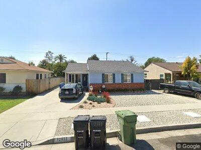
12632 Putnam St Whittier, CA 90602
Estimated Value: $620,000 - $787,000
3
Beds
1
Bath
1,063
Sq Ft
$665/Sq Ft
Est. Value
About This Home
This home is located at 12632 Putnam St, Whittier, CA 90602 and is currently estimated at $707,305, approximately $665 per square foot. 12632 Putnam St is a home located in Los Angeles County with nearby schools including Evergreen Elementary School, East Whittier Middle School, and Whittier High School.
Ownership History
Date
Name
Owned For
Owner Type
Purchase Details
Closed on
Dec 10, 2018
Sold by
Guerrero Rudoiph Garcia and Guerrero Susana M
Bought by
Guerrero Rudolph Garcia and Guerrero Susana M
Current Estimated Value
Purchase Details
Closed on
Apr 17, 2001
Sold by
Guerrero Rudolph Garcia
Bought by
Guerrero Rudolph Garcia
Home Financials for this Owner
Home Financials are based on the most recent Mortgage that was taken out on this home.
Original Mortgage
$99,900
Interest Rate
6.98%
Mortgage Type
Credit Line Revolving
Create a Home Valuation Report for This Property
The Home Valuation Report is an in-depth analysis detailing your home's value as well as a comparison with similar homes in the area
Home Values in the Area
Average Home Value in this Area
Purchase History
| Date | Buyer | Sale Price | Title Company |
|---|---|---|---|
| Guerrero Rudolph Garcia | -- | None Available | |
| Guerrero Rudolph Garcia | -- | Chicago Title Co |
Source: Public Records
Mortgage History
| Date | Status | Borrower | Loan Amount |
|---|---|---|---|
| Closed | Guerrero Rudolph Garcia | $99,900 |
Source: Public Records
Tax History Compared to Growth
Tax History
| Year | Tax Paid | Tax Assessment Tax Assessment Total Assessment is a certain percentage of the fair market value that is determined by local assessors to be the total taxable value of land and additions on the property. | Land | Improvement |
|---|---|---|---|---|
| 2024 | $3,550 | $273,572 | $187,902 | $85,670 |
| 2023 | $3,493 | $268,209 | $184,218 | $83,991 |
| 2022 | $3,410 | $262,951 | $180,606 | $82,345 |
| 2021 | $3,624 | $257,796 | $177,065 | $80,731 |
| 2020 | $3,573 | $255,154 | $175,250 | $79,904 |
| 2019 | $3,391 | $250,152 | $171,814 | $78,338 |
| 2018 | $3,182 | $245,248 | $168,446 | $76,802 |
| 2016 | $2,975 | $235,727 | $161,906 | $73,821 |
| 2015 | $2,971 | $232,188 | $159,475 | $72,713 |
| 2014 | $2,937 | $227,641 | $156,352 | $71,289 |
Source: Public Records
Map
Nearby Homes
- 12800 Oak St
- 12429 Lambert Rd Unit 12423
- 8720 Villa Dr
- 8017 Greenleaf Ave
- 13100 Oak St
- 8146 Bright Ave
- 7757 Comstock Ave
- 13210 Lambert Rd
- 8537 Painter Ave
- 12732 McGee Dr
- 12536 McGee Dr
- 7641 Bright Ave
- 7339 Milton Ave
- 7945 Caldwell Ave
- 13407 Helen St
- 12630 Penn St
- 7817 Barnum Dr
- 7932 Rhea Vista Dr
- 12270 Blue Sky Ct
- 13239 Mulberry Dr