1266 Schaumburg Rd Elgin, IL 60120
South Hoffman Estates NeighborhoodEstimated Value: $1,016,000 - $1,696,000
5
Beds
5
Baths
6,123
Sq Ft
$213/Sq Ft
Est. Value
About This Home
This home is located at 1266 Schaumburg Rd, Elgin, IL 60120 and is currently estimated at $1,303,681, approximately $212 per square foot. 1266 Schaumburg Rd is a home located in Cook County with nearby schools including Hilltop Elementary School, Canton Middle School, and Streamwood High School.
Ownership History
Date
Name
Owned For
Owner Type
Purchase Details
Closed on
Jan 23, 2024
Sold by
Rittmann Stephen P and Rittmann Bobbi Jo
Bought by
Stephen P Rittmann And Bobbi Jo Rittmann Join and Rittmann
Current Estimated Value
Purchase Details
Closed on
May 1, 1995
Sold by
Manuel Edward A and Manuel Margaret J
Bought by
Manuel Edward A and Manuel Margaret J
Create a Home Valuation Report for This Property
The Home Valuation Report is an in-depth analysis detailing your home's value as well as a comparison with similar homes in the area
Home Values in the Area
Average Home Value in this Area
Purchase History
| Date | Buyer | Sale Price | Title Company |
|---|---|---|---|
| Stephen P Rittmann And Bobbi Jo Rittmann Join | -- | None Listed On Document | |
| Manuel Edward A | -- | -- |
Source: Public Records
Mortgage History
| Date | Status | Borrower | Loan Amount |
|---|---|---|---|
| Open | Stephen P Rittmann P | $250,000 | |
| Previous Owner | Rittmann Stephen P | $295,000 | |
| Previous Owner | Rittmann Stephen P | $250,000 | |
| Previous Owner | Rittmann Stephen P | $417,000 | |
| Previous Owner | Rittmann Stephen P | $200,000 | |
| Previous Owner | Rittmann Stephen P | $75,000 |
Source: Public Records
Tax History Compared to Growth
Tax History
| Year | Tax Paid | Tax Assessment Tax Assessment Total Assessment is a certain percentage of the fair market value that is determined by local assessors to be the total taxable value of land and additions on the property. | Land | Improvement |
|---|---|---|---|---|
| 2024 | $18,456 | $78,976 | $39,476 | $39,500 |
| 2023 | $18,456 | $78,976 | $39,476 | $39,500 |
| 2022 | $18,456 | $78,976 | $39,476 | $39,500 |
| 2021 | $33,186 | $113,757 | $60,919 | $52,838 |
| 2020 | $32,794 | $113,757 | $60,919 | $52,838 |
| 2019 | $32,428 | $126,397 | $60,919 | $65,478 |
| 2018 | $39,126 | $132,412 | $48,735 | $83,677 |
| 2017 | $36,472 | $132,412 | $48,735 | $83,677 |
| 2016 | $34,635 | $132,412 | $48,735 | $83,677 |
| 2015 | $32,283 | $111,210 | $36,551 | $74,659 |
| 2014 | $31,829 | $111,210 | $36,551 | $74,659 |
| 2013 | $30,697 | $111,210 | $36,551 | $74,659 |
Source: Public Records
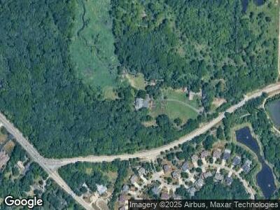
Map
Nearby Homes
- 105 Cottonwood Dr
- 99 Gromer Rd
- 9 Thistle Ct
- 47 White Fence Trail
- 130 Forestview Dr
- 828 Beech Dr
- 7 Buckskin Ln
- 125 Buckskin Ln
- 135 Buckskin Ln
- 104 Gloria Dr
- 108 Gloria Dr
- 306 Foxglove Ct
- 319 Foxglove Ct
- 321 Foxglove Ct
- 302 Foxglove Ct
- 110 Gloria Dr
- 13 Trail Ridge Ct
- 1564 Yellowstone Dr
- 47 Augusta Dr
- 157 Augusta Dr