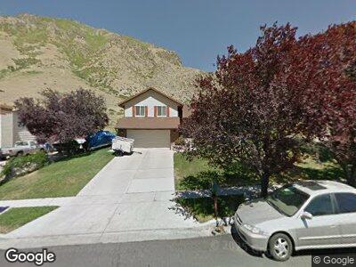
1270 N Millpond Dr Springville, UT 84663
Little Rock Canyon NeighborhoodEstimated Value: $535,000 - $599,000
5
Beds
3
Baths
2,826
Sq Ft
$200/Sq Ft
Est. Value
About This Home
This home is located at 1270 N Millpond Dr, Springville, UT 84663 and is currently estimated at $565,381, approximately $200 per square foot. 1270 N Millpond Dr is a home located in Utah County with nearby schools including Cherry Creek Elementary School, Springville Junior High School, and Springville High School.
Ownership History
Date
Name
Owned For
Owner Type
Purchase Details
Closed on
Feb 22, 2023
Sold by
Catamount Properties 2018 Llc
Bought by
Weisinger John Claude and Weisinger Lora L
Current Estimated Value
Home Financials for this Owner
Home Financials are based on the most recent Mortgage that was taken out on this home.
Original Mortgage
$518,000
Interest Rate
6.28%
Mortgage Type
VA
Purchase Details
Closed on
Jun 9, 2022
Sold by
Lundberg & Associates Pc
Bought by
Catamount Properties 2018 Llc
Purchase Details
Closed on
Sep 28, 2017
Sold by
Stoddard Kenneth and Stoddard Paulette G
Bought by
Houghton Christopher P
Home Financials for this Owner
Home Financials are based on the most recent Mortgage that was taken out on this home.
Original Mortgage
$294,566
Interest Rate
3.89%
Mortgage Type
FHA
Purchase Details
Closed on
Jan 19, 2001
Sold by
Shanto Arthur J and Shanto Sharon A
Bought by
Stoddard Kenneth and Stoddard Paulette G
Create a Home Valuation Report for This Property
The Home Valuation Report is an in-depth analysis detailing your home's value as well as a comparison with similar homes in the area
Home Values in the Area
Average Home Value in this Area
Purchase History
| Date | Buyer | Sale Price | Title Company |
|---|---|---|---|
| Weisinger John Claude | -- | Inwest Title | |
| Catamount Properties 2018 Llc | -- | None Listed On Document | |
| Houghton Christopher P | -- | Provo Land Title Co | |
| Stoddard Kenneth | -- | Old Republic Title |
Source: Public Records
Mortgage History
| Date | Status | Borrower | Loan Amount |
|---|---|---|---|
| Open | Weisinger John Claude | $527,110 | |
| Previous Owner | Weisinger John Claude | $518,000 | |
| Previous Owner | Houghton Christopher P | $294,566 | |
| Previous Owner | Houghton Christopher P | $10,500 | |
| Previous Owner | Stoddard Kenneth | $92,000 | |
| Previous Owner | Stoddard Kenneth | $25,000 | |
| Previous Owner | Stoddard Kenneth | $108,233 | |
| Previous Owner | Stoddard Kenneth | $129,000 | |
| Previous Owner | Stoddard Kenneth | $129,099 |
Source: Public Records
Tax History Compared to Growth
Tax History
| Year | Tax Paid | Tax Assessment Tax Assessment Total Assessment is a certain percentage of the fair market value that is determined by local assessors to be the total taxable value of land and additions on the property. | Land | Improvement |
|---|---|---|---|---|
| 2024 | $2,463 | $253,275 | $0 | $0 |
| 2023 | $358 | $252,615 | $0 | $0 |
| 2022 | $2,304 | $232,045 | $0 | $0 |
| 2021 | $1,984 | $311,100 | $87,200 | $223,900 |
| 2020 | $1,932 | $293,600 | $75,800 | $217,800 |
| 2019 | $1,692 | $261,800 | $72,400 | $189,400 |
| 2018 | $1,717 | $253,500 | $64,100 | $189,400 |
| 2017 | $1,566 | $122,815 | $0 | $0 |
| 2016 | $1,462 | $112,365 | $0 | $0 |
| 2015 | $1,388 | $109,065 | $0 | $0 |
| 2014 | $1,336 | $104,335 | $0 | $0 |
Source: Public Records
Map
Nearby Homes
- 893 N 400 E
- 1001 N Main St
- 850 N Main St Unit 24
- 850 N Main St Unit 27
- 850 N Main St Unit 20
- 739 N 400 E
- 1025 N 300 W Unit 43
- 290 N 300 E
- 410 N 250 W
- 686 Cutler Ave
- 360 W 400 N Unit 1
- 328 E 200 N
- 312 N 800 E
- 325 N 1040 St E Unit 26
- 115 N 750 E
- 276 N 1100 E
- 386 N 650 W
- 68 N 300 W
- 311 E 100 S
- 156 N 600 W