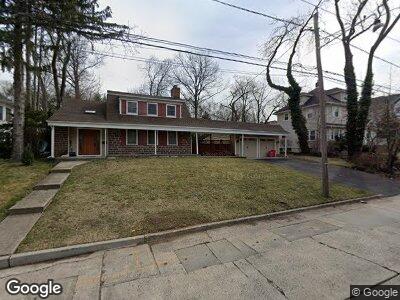
1271 Hastings St Teaneck, NJ 07666
Teaneck NeighborhoodEstimated Value: $769,000 - $995,000
--
Bed
--
Bath
1,774
Sq Ft
$475/Sq Ft
Est. Value
About This Home
This home is located at 1271 Hastings St, Teaneck, NJ 07666 and is currently estimated at $842,635, approximately $474 per square foot. 1271 Hastings St is a home located in Bergen County with nearby schools including Teaneck Senior High School, Grace Lutheran School, and Yeshivat He'atid.
Ownership History
Date
Name
Owned For
Owner Type
Purchase Details
Closed on
Oct 31, 2011
Sold by
Hirshberg Ellen S and Hirshberg Sharon L
Bought by
Hirshberg Ellen S
Current Estimated Value
Purchase Details
Closed on
Dec 6, 2000
Bought by
Hirshberg Sharon
Home Financials for this Owner
Home Financials are based on the most recent Mortgage that was taken out on this home.
Original Mortgage
$24,245
Interest Rate
7.64%
Create a Home Valuation Report for This Property
The Home Valuation Report is an in-depth analysis detailing your home's value as well as a comparison with similar homes in the area
Home Values in the Area
Average Home Value in this Area
Purchase History
| Date | Buyer | Sale Price | Title Company |
|---|---|---|---|
| Hirshberg Ellen S | -- | -- | |
| Hirshberg Sharon | -- | -- | |
| Hirshberg Sharon | -- | -- |
Source: Public Records
Mortgage History
| Date | Status | Borrower | Loan Amount |
|---|---|---|---|
| Open | Hirshberg Ellen S | $90,000 | |
| Previous Owner | Hirshberg Sharon | $24,245 | |
| Previous Owner | Hirshberg S L | $12,000 |
Source: Public Records
Tax History Compared to Growth
Tax History
| Year | Tax Paid | Tax Assessment Tax Assessment Total Assessment is a certain percentage of the fair market value that is determined by local assessors to be the total taxable value of land and additions on the property. | Land | Improvement |
|---|---|---|---|---|
| 2024 | $15,060 | $777,100 | $508,000 | $269,100 |
| 2023 | $14,764 | $456,100 | $294,000 | $162,100 |
| 2022 | $14,764 | $456,100 | $294,000 | $162,100 |
| 2021 | $14,851 | $456,100 | $294,000 | $162,100 |
| 2020 | $14,750 | $456,100 | $294,000 | $162,100 |
| 2019 | $14,582 | $456,100 | $294,000 | $162,100 |
| 2018 | $14,472 | $456,100 | $294,000 | $162,100 |
| 2017 | $14,335 | $456,100 | $294,000 | $162,100 |
| 2016 | $14,121 | $456,100 | $294,000 | $162,100 |
| 2015 | $13,897 | $456,100 | $294,000 | $162,100 |
| 2014 | $15,148 | $582,300 | $394,000 | $188,300 |
Source: Public Records
Map
Nearby Homes
- 475 Forest Ave
- 1219 Sussex Rd
- 1220 W Laurelton Pkwy
- 1391 Somerset Gate
- 1272 E Laurelton Pkwy
- 569 Maitland Ave
- 563 Maitland Ave
- 1333 Princeton Rd
- 1109 Sussex Rd
- 1156 Kensington Rd
- 539 Maitland Ave
- 1153 River Rd
- 1081 Lambert Rd
- 532 Winthrop Rd
- 299 Rutland Ave
- 486 Wyndham Rd
- 1444 Windsor Rd
- 1500 River Rd
- 507 Sagamore Ave
- 451 Sagamore Ave