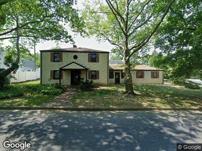
128 Camp St Emmaus, PA 18049
Estimated Value: $271,000 - $355,000
3
Beds
1
Bath
1,892
Sq Ft
$165/Sq Ft
Est. Value
About This Home
This home is located at 128 Camp St, Emmaus, PA 18049 and is currently estimated at $312,447, approximately $165 per square foot. 128 Camp St is a home located in Lehigh County with nearby schools including Lincoln Elementary School, Lower Macungie Middle School, and Emmaus High School.
Ownership History
Date
Name
Owned For
Owner Type
Purchase Details
Closed on
Mar 6, 2024
Sold by
Lehigh County Of Sheriff
Bought by
128 Camp Street Holdings Llc
Current Estimated Value
Purchase Details
Closed on
Jul 11, 2002
Sold by
Michaels Joseph R and Michaels Jamie S
Bought by
Michaels Joseph R
Home Financials for this Owner
Home Financials are based on the most recent Mortgage that was taken out on this home.
Original Mortgage
$139,792
Interest Rate
6.39%
Mortgage Type
Purchase Money Mortgage
Purchase Details
Closed on
Feb 9, 2001
Sold by
Michaels Joseph R and Michaels Jamie S
Bought by
Michaels Joseph R and Michaels Jamie S
Purchase Details
Closed on
Aug 26, 1991
Sold by
Schmoyer Ronald E and Schmoyer Carol A
Bought by
Michaels Joseph R and Michaels Kemmerer J
Purchase Details
Closed on
Nov 19, 1975
Bought by
Schmoyer Ronald E and Schmoyer Carol A
Create a Home Valuation Report for This Property
The Home Valuation Report is an in-depth analysis detailing your home's value as well as a comparison with similar homes in the area
Home Values in the Area
Average Home Value in this Area
Purchase History
| Date | Buyer | Sale Price | Title Company |
|---|---|---|---|
| 128 Camp Street Holdings Llc | $260,000 | None Listed On Document | |
| Michaels Joseph R | -- | First American Title Ins Co | |
| Michaels Joseph R | -- | -- | |
| Michaels Joseph R | $130,000 | -- | |
| Schmoyer Ronald E | $36,800 | -- |
Source: Public Records
Mortgage History
| Date | Status | Borrower | Loan Amount |
|---|---|---|---|
| Previous Owner | Michaels Joseph R | $15,500 | |
| Previous Owner | Michaels Joseph R | $139,792 |
Source: Public Records
Tax History Compared to Growth
Tax History
| Year | Tax Paid | Tax Assessment Tax Assessment Total Assessment is a certain percentage of the fair market value that is determined by local assessors to be the total taxable value of land and additions on the property. | Land | Improvement |
|---|---|---|---|---|
| 2025 | $6,140 | $174,300 | $27,900 | $146,400 |
| 2024 | $5,624 | $174,300 | $27,900 | $146,400 |
| 2023 | $5,515 | $174,300 | $27,900 | $146,400 |
| 2022 | $5,333 | $174,300 | $146,400 | $27,900 |
| 2021 | $5,199 | $174,300 | $27,900 | $146,400 |
| 2020 | $5,154 | $174,300 | $27,900 | $146,400 |
| 2019 | $5,017 | $174,300 | $27,900 | $146,400 |
| 2018 | $4,828 | $174,300 | $27,900 | $146,400 |
| 2017 | $4,679 | $174,300 | $27,900 | $146,400 |
| 2016 | -- | $174,300 | $27,900 | $146,400 |
| 2015 | -- | $174,300 | $27,900 | $146,400 |
| 2014 | -- | $174,300 | $27,900 | $146,400 |
Source: Public Records
Map
Nearby Homes
- 101 Eagle St
- 515 Dalton St
- 101 Alpine St
- 2538 S 30th St SW
- 152 Jefferson St
- 2960 Huron St
- 1918 31st St SW Unit 1920
- 3218 Alton St
- 1814 32nd St SW
- 2833 Huron St
- 2835 Ithaca St
- 2707 Broder St SW
- 2701 26th St SW
- 2637 26th St SW
- 102 Garden Ct
- 2627 Appel St
- 2708 Barnes Ct
- 237 North St
- 22 S 2nd St
- 315 Cherokee St