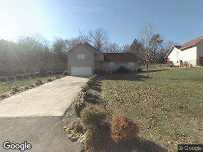
128 Mohawk Trail La Follette, TN 37766
Estimated Value: $242,000 - $279,269
2
Beds
2
Baths
1,812
Sq Ft
$147/Sq Ft
Est. Value
About This Home
This home is located at 128 Mohawk Trail, La Follette, TN 37766 and is currently estimated at $266,317, approximately $146 per square foot. 128 Mohawk Trail is a home located in Campbell County with nearby schools including Calvary Christian Academy.
Ownership History
Date
Name
Owned For
Owner Type
Purchase Details
Closed on
Jul 7, 2019
Sold by
Roberts Venice L and Roberts Frances Jean
Bought by
Woodson Dustin
Current Estimated Value
Purchase Details
Closed on
Oct 23, 2018
Sold by
Burcham Deal Linda
Bought by
Kidwell Mark
Purchase Details
Closed on
Feb 27, 2015
Sold by
Burcham Thelma Faye
Bought by
Burhcham Thelma Faye and Burhcham Linda Burcham
Purchase Details
Closed on
Dec 31, 2012
Sold by
Gfb Land Co Inc
Bought by
Burcham Thelma Faye
Purchase Details
Closed on
Jan 4, 2007
Sold by
Burcham Faye
Bought by
Gfb Land Company Inc
Purchase Details
Closed on
Jan 3, 1985
Bought by
Burcham Faye
Purchase Details
Closed on
Jun 10, 1980
Create a Home Valuation Report for This Property
The Home Valuation Report is an in-depth analysis detailing your home's value as well as a comparison with similar homes in the area
Home Values in the Area
Average Home Value in this Area
Purchase History
| Date | Buyer | Sale Price | Title Company |
|---|---|---|---|
| Woodson Dustin | -- | None Available | |
| Roberts Venice L | -- | None Available | |
| Kidwell Mark | $55,000 | None Available | |
| Burhcham Thelma Faye | -- | -- | |
| Burcham Thelma Faye | -- | -- | |
| Burcham Thelma Faye | -- | -- | |
| Gfb Land Company Inc | -- | -- | |
| Burcham Faye | -- | -- | |
| -- | -- | -- |
Source: Public Records
Mortgage History
| Date | Status | Borrower | Loan Amount |
|---|---|---|---|
| Previous Owner | Burcham George R | $15,000 |
Source: Public Records
Tax History Compared to Growth
Tax History
| Year | Tax Paid | Tax Assessment Tax Assessment Total Assessment is a certain percentage of the fair market value that is determined by local assessors to be the total taxable value of land and additions on the property. | Land | Improvement |
|---|---|---|---|---|
| 2024 | -- | $73,800 | $7,650 | $66,150 |
| 2023 | $1,098 | $32,650 | $4,600 | $28,050 |
| 2022 | $1,098 | $32,650 | $4,600 | $28,050 |
| 2021 | $1,098 | $32,650 | $4,600 | $28,050 |
| 2020 | $1,076 | $32,650 | $4,600 | $28,050 |
| 2019 | $1,098 | $32,650 | $4,600 | $28,050 |
| 2018 | $1,097 | $30,950 | $3,775 | $27,175 |
| 2017 | $1,097 | $30,950 | $3,775 | $27,175 |
| 2016 | $1,097 | $30,950 | $3,775 | $27,175 |
| 2015 | $1,017 | $30,950 | $3,775 | $27,175 |
| 2014 | -- | $30,950 | $3,775 | $27,175 |
| 2013 | -- | $30,950 | $3,775 | $27,175 |
Source: Public Records
Map
Nearby Homes
- 1120 Loop Rd
- 215 Hilltop Rd
- 144 Pleasant Ln
- 312 E Hemlock St
- 213 W Fir St
- 705 S 11th St
- 414 W Hemlock St
- 0 W Hemlock St
- 708 S Cumberland Ave
- 0 Dr
- 915 S Massachusetts Ave
- 406 S Indiana Ave
- 608 S Cumberland Ave
- 313 W Chestnut St
- 182 Hickory Hill
- 162 Andy Baird Dr
- 416 Summitt Dr
- 105 W Ash St
- 0 Highland Dr Unit 1291296
- 506 E Ash St