1296 Liberty Pike Franklin, TN 37067
McEwen NeighborhoodEstimated Value: $831,000 - $5,060,795
--
Bed
1
Bath
11,934
Sq Ft
$271/Sq Ft
Est. Value
About This Home
This home is located at 1296 Liberty Pike, Franklin, TN 37067 and is currently estimated at $3,237,199, approximately $271 per square foot. 1296 Liberty Pike is a home located in Williamson County with nearby schools including Clovercroft Elementary School, Fred J. Page Middle School, and Centennial High School.
Ownership History
Date
Name
Owned For
Owner Type
Purchase Details
Closed on
Dec 11, 2020
Sold by
Kuhlo Ernest C
Bought by
Esmaeili Farnaz
Current Estimated Value
Purchase Details
Closed on
Nov 25, 2015
Sold by
Kuhlo Ernest C and Kuhlo Patricia O
Bought by
Kuhlo Ernest C
Purchase Details
Closed on
Aug 1, 2002
Sold by
Jones Land Company Llc
Bought by
Kuhlo Ernest C and Kuhlo Patricia O
Create a Home Valuation Report for This Property
The Home Valuation Report is an in-depth analysis detailing your home's value as well as a comparison with similar homes in the area
Home Values in the Area
Average Home Value in this Area
Purchase History
| Date | Buyer | Sale Price | Title Company |
|---|---|---|---|
| Esmaeili Farnaz | $2,550,000 | Athens Title & Escrow Llc | |
| Kuhlo Ernest C | -- | Chapman & Rosenthal Title In | |
| Kuhlo Ernest C | -- | -- |
Source: Public Records
Mortgage History
| Date | Status | Borrower | Loan Amount |
|---|---|---|---|
| Previous Owner | Kuhlo Ernest C | $1,531,900 | |
| Previous Owner | Kuhlo Ernest C | $1,385,999 | |
| Previous Owner | Kuhlo Ernest C | $450,000 | |
| Previous Owner | Kuhlo Ernest C | $1,370,000 | |
| Previous Owner | Kuhlo Ernest C | $1,360,000 |
Source: Public Records
Tax History Compared to Growth
Tax History
| Year | Tax Paid | Tax Assessment Tax Assessment Total Assessment is a certain percentage of the fair market value that is determined by local assessors to be the total taxable value of land and additions on the property. | Land | Improvement |
|---|---|---|---|---|
| 2024 | $13,803 | $640,175 | $89,075 | $551,100 |
| 2023 | $13,803 | $640,175 | $89,075 | $551,100 |
| 2022 | $13,803 | $640,175 | $89,075 | $551,100 |
| 2021 | $13,803 | $640,175 | $89,075 | $551,100 |
| 2020 | $11,599 | $450,000 | $59,375 | $390,625 |
| 2019 | $11,599 | $450,000 | $59,375 | $390,625 |
| 2018 | $11,284 | $450,000 | $59,375 | $390,625 |
| 2017 | $11,194 | $450,000 | $59,375 | $390,625 |
| 2016 | $0 | $450,000 | $59,375 | $390,625 |
| 2015 | -- | $473,025 | $45,675 | $427,350 |
| 2014 | -- | $473,025 | $45,675 | $427,350 |
Source: Public Records
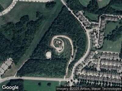
Map
Nearby Homes
- 1027 Park Run Dr Unit 1027
- 1213 Park Run Dr Unit 1213
- 1706 Decatur Cir
- 1920 Montgomery Way
- 1522 Brentwood Pointe Sec 3
- 9263 Stepping Stone Dr
- 3005 Coral Bell Ln
- 0 Liberty Pike
- 1010 Dunrobin Dr
- 3036 Oxford Glen Dr
- 2004 Brewster Dr
- 3044 Oxford Glen Dr
- 1013 Laguna Dr
- 1007 Laguna Dr
- 1001 Laguna Dr
- 1006 Laguna Dr
- 4079 Clovercroft Rd
- 4075 Clovercroft Rd
- 528 Eden Park Dr
- 286 Keswick Grove Ln