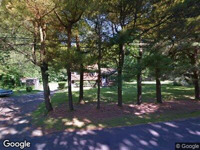
132 N Airline Rd Wallingford, CT 06492
Wallingford NeighborhoodEstimated Value: $324,405 - $384,000
3
Beds
2
Baths
1,428
Sq Ft
$244/Sq Ft
Est. Value
About This Home
This home is located at 132 N Airline Rd, Wallingford, CT 06492 and is currently estimated at $347,851, approximately $243 per square foot. 132 N Airline Rd is a home located in New Haven County with nearby schools including Moses Y Beach Elementary School, Rock Hill Elementary School, and Dag Hammarskjold Middle School.
Ownership History
Date
Name
Owned For
Owner Type
Purchase Details
Closed on
Oct 11, 2024
Sold by
Phh Mortgage Corp
Bought by
Federal Natl Mortgage Ass
Current Estimated Value
Purchase Details
Closed on
Jul 23, 2024
Sold by
Phh Mtg Corp
Bought by
Phh Mtg Corp
Create a Home Valuation Report for This Property
The Home Valuation Report is an in-depth analysis detailing your home's value as well as a comparison with similar homes in the area
Home Values in the Area
Average Home Value in this Area
Purchase History
| Date | Buyer | Sale Price | Title Company |
|---|---|---|---|
| Federal Natl Mortgage Ass | -- | None Available | |
| Federal Natl Mortgage Ass | -- | None Available | |
| Phh Mtg Corp | $300,000 | None Available | |
| Phh Mtg Corp | $300,000 | None Available |
Source: Public Records
Mortgage History
| Date | Status | Borrower | Loan Amount |
|---|---|---|---|
| Previous Owner | Passmore Archie | $424,500 | |
| Previous Owner | Passmore Archie | $115,000 |
Source: Public Records
Tax History Compared to Growth
Tax History
| Year | Tax Paid | Tax Assessment Tax Assessment Total Assessment is a certain percentage of the fair market value that is determined by local assessors to be the total taxable value of land and additions on the property. | Land | Improvement |
|---|---|---|---|---|
| 2024 | $4,896 | $159,700 | $85,600 | $74,100 |
| 2023 | $4,686 | $159,700 | $85,600 | $74,100 |
| 2022 | $4,638 | $159,700 | $85,600 | $74,100 |
| 2021 | $4,555 | $159,700 | $85,600 | $74,100 |
| 2020 | $4,522 | $154,900 | $84,900 | $70,000 |
| 2019 | $4,522 | $154,900 | $84,900 | $70,000 |
| 2018 | $4,436 | $154,900 | $84,900 | $70,000 |
| 2017 | $4,422 | $154,900 | $84,900 | $70,000 |
| 2016 | $4,320 | $154,900 | $84,900 | $70,000 |
| 2015 | $4,280 | $155,800 | $84,700 | $71,100 |
| 2014 | $4,189 | $155,800 | $84,700 | $71,100 |
Source: Public Records
Map
Nearby Homes
- 194 N Airline Rd
- 72 Cooper Ave
- 117 E Side Dr
- 6 Malchiodi Dr
- 78 Putter Dr Unit N310
- 73 Putter Dr Unit 214N
- 124 Constitution St Unit 5
- 32 Mapleview Rd
- 140 Woodhouse Ave
- 22 Broadmeadow Rd
- 631 Center St
- 291 Grieb Rd
- 24 Shady Dr
- 583 Ward Street Extension
- 15 N Elm St
- 13 Reene Ln
- 16 Woodland Dr
- 31 Eaton Dr
- 20 Dannys Way
- 37 Mulligan Dr