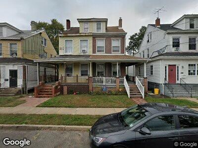
1322 William St Trenton, NJ 08610
Hamilton Township NeighborhoodEstimated Value: $235,054 - $267,000
3
Beds
1
Bath
1,232
Sq Ft
$208/Sq Ft
Est. Value
About This Home
This home is located at 1322 William St, Trenton, NJ 08610 and is currently estimated at $256,764, approximately $208 per square foot. 1322 William St is a home located in Mercer County with nearby schools including George E. Wilson Elementary School, Albert E. Grice Middle School, and Hamilton West-Watson High School.
Ownership History
Date
Name
Owned For
Owner Type
Purchase Details
Closed on
Jun 12, 2018
Sold by
12 Mervine Place Llc
Bought by
Mercer Golders Green Llc
Current Estimated Value
Purchase Details
Closed on
Aug 17, 2016
Sold by
Tard Rhonda and Tard Thomas
Bought by
12 Mervine Place Llc
Purchase Details
Closed on
Sep 17, 2012
Sold by
Tard Rhonda
Bought by
Hall Vandy
Purchase Details
Closed on
Apr 21, 1999
Sold by
Burney Eva
Bought by
Tard Rhonda
Home Financials for this Owner
Home Financials are based on the most recent Mortgage that was taken out on this home.
Original Mortgage
$41,978
Interest Rate
6.92%
Mortgage Type
FHA
Create a Home Valuation Report for This Property
The Home Valuation Report is an in-depth analysis detailing your home's value as well as a comparison with similar homes in the area
Home Values in the Area
Average Home Value in this Area
Purchase History
| Date | Buyer | Sale Price | Title Company |
|---|---|---|---|
| Mercer Golders Green Llc | -- | Os National Llc | |
| 12 Mervine Place Llc | $37,025 | None Available | |
| Hall Vandy | -- | None Available | |
| Tard Rhonda | $42,000 | -- |
Source: Public Records
Mortgage History
| Date | Status | Borrower | Loan Amount |
|---|---|---|---|
| Previous Owner | Tard Rhonda | $41,978 |
Source: Public Records
Tax History Compared to Growth
Tax History
| Year | Tax Paid | Tax Assessment Tax Assessment Total Assessment is a certain percentage of the fair market value that is determined by local assessors to be the total taxable value of land and additions on the property. | Land | Improvement |
|---|---|---|---|---|
| 2024 | $3,118 | $94,400 | $25,100 | $69,300 |
| 2023 | $3,118 | $94,400 | $25,100 | $69,300 |
| 2022 | $3,069 | $94,400 | $25,100 | $69,300 |
| 2021 | $3,798 | $94,400 | $25,100 | $69,300 |
| 2020 | $3,458 | $94,400 | $25,100 | $69,300 |
| 2019 | $3,548 | $99,800 | $25,100 | $74,700 |
| 2018 | $3,501 | $99,800 | $25,100 | $74,700 |
| 2017 | $3,345 | $99,800 | $25,100 | $74,700 |
| 2016 | $2,699 | $99,800 | $25,100 | $74,700 |
| 2015 | $4,219 | $81,000 | $17,100 | $63,900 |
| 2014 | $4,164 | $81,000 | $17,100 | $63,900 |
Source: Public Records
Map
Nearby Homes
- 235 Wilfred Ave
- 2037 S Broad St
- 1857 S Broad St
- 408 Berg Ave
- 314 Joseph St
- 322 Berg Ave
- 1604 Genesee St
- 537 Schiller Ave
- 101 Grand Ave
- 659 Hunt Ave
- 311 Mcclellan Ave
- 624 Hunt Ave
- 359 Mcclellan Ave
- 2032 S Clinton Ave
- 111 Lake Ave
- 124 Samdin Blvd
- 316 W Park Ave
- 403 W Park Ave
- 572 Ridge Ave
- 27 Annabelle Ave