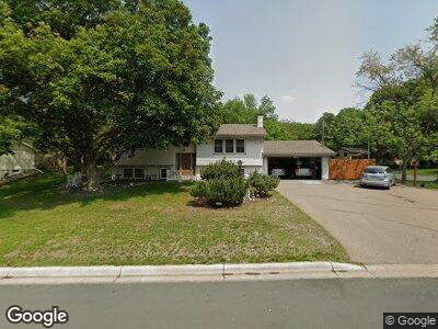
13277 Humboldt Ave S Burnsville, MN 55337
Estimated Value: $337,649 - $405,000
4
Beds
3
Baths
1,112
Sq Ft
$327/Sq Ft
Est. Value
About This Home
This home is located at 13277 Humboldt Ave S, Burnsville, MN 55337 and is currently estimated at $363,912, approximately $327 per square foot. 13277 Humboldt Ave S is a home located in Dakota County with nearby schools including Vista View Elementary School, Joseph Nicollet Middle School, and Burnsville High School.
Ownership History
Date
Name
Owned For
Owner Type
Purchase Details
Closed on
Jan 5, 2010
Sold by
Bruesehoff Audre Jane and Bruesehoff William A
Bought by
Bluemke Joseph F and Bluemke Lisa K
Current Estimated Value
Home Financials for this Owner
Home Financials are based on the most recent Mortgage that was taken out on this home.
Original Mortgage
$150,350
Outstanding Balance
$101,041
Interest Rate
4.87%
Mortgage Type
New Conventional
Estimated Equity
$262,871
Create a Home Valuation Report for This Property
The Home Valuation Report is an in-depth analysis detailing your home's value as well as a comparison with similar homes in the area
Home Values in the Area
Average Home Value in this Area
Purchase History
| Date | Buyer | Sale Price | Title Company |
|---|---|---|---|
| Bluemke Joseph F | $200,500 | Burnet Title |
Source: Public Records
Mortgage History
| Date | Status | Borrower | Loan Amount |
|---|---|---|---|
| Open | Bluemke Joseph F | $75,646 | |
| Closed | Bluemke Joseph F | $30,000 | |
| Open | Bluemke Joseph F | $150,350 |
Source: Public Records
Tax History Compared to Growth
Tax History
| Year | Tax Paid | Tax Assessment Tax Assessment Total Assessment is a certain percentage of the fair market value that is determined by local assessors to be the total taxable value of land and additions on the property. | Land | Improvement |
|---|---|---|---|---|
| 2023 | $3,168 | $308,500 | $83,900 | $224,600 |
| 2022 | $2,652 | $300,700 | $83,700 | $217,000 |
| 2021 | $2,744 | $257,700 | $72,800 | $184,900 |
| 2020 | $2,772 | $253,100 | $69,300 | $183,800 |
| 2019 | $2,737 | $246,800 | $66,000 | $180,800 |
| 2018 | $2,495 | $233,200 | $62,900 | $170,300 |
| 2017 | $2,327 | $209,100 | $59,900 | $149,200 |
| 2016 | $2,385 | $194,200 | $57,100 | $137,100 |
| 2015 | $2,125 | $171,277 | $49,601 | $121,676 |
| 2014 | -- | $158,742 | $48,029 | $110,713 |
| 2013 | -- | $137,814 | $42,734 | $95,080 |
Source: Public Records
Map
Nearby Homes
- 901 Garrison Ct
- 1509 Lyndale Cir
- 1876 W Burnsville Pkwy
- 13013 Girard Ave S
- 511 Timberland Dr
- 1908 E Manor Blvd
- 1900 Manor Dr
- 400 Hemlock Dr
- 1616 W 139th St
- 1704 James Place
- 1304 W 140th St
- 1469 Woodhill Rd
- 13015 Oliver Ave S
- 1721 James Place
- 13724 Shirley Dr
- 1661 W 140th St
- XXXX Woodhill Rd
- 1613 W 140th St
- 140 Timberland Dr
- 1717 W 140th St