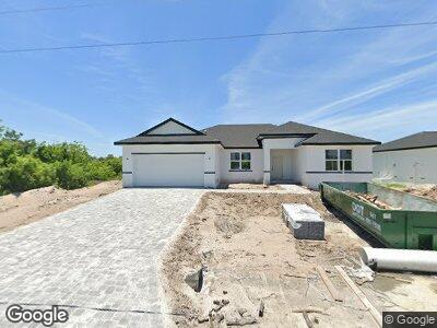
13343 Holtville Ave Port Charlotte, FL 33981
Estimated Value: $359,000 - $377,879
4
Beds
3
Baths
1,903
Sq Ft
$194/Sq Ft
Est. Value
About This Home
This home is located at 13343 Holtville Ave, Port Charlotte, FL 33981 and is currently estimated at $368,720, approximately $193 per square foot. 13343 Holtville Ave is a home located in Charlotte County with nearby schools including Myakka River Elementary School, L.A. Ainger Middle School, and Lemon Bay High School.
Ownership History
Date
Name
Owned For
Owner Type
Purchase Details
Closed on
Jul 9, 2021
Sold by
Saadeh Ali
Bought by
Visionpro Llc
Current Estimated Value
Purchase Details
Closed on
Aug 30, 2007
Sold by
Mercedes Homes Inc
Bought by
Saadeh Ali
Purchase Details
Closed on
Sep 1, 2005
Sold by
Pelcha & Taleff Llc
Bought by
Mercedes Homes Inc
Purchase Details
Closed on
Feb 26, 2004
Sold by
Cliff Ronald J
Bought by
El Jobean Ent Tr
Create a Home Valuation Report for This Property
The Home Valuation Report is an in-depth analysis detailing your home's value as well as a comparison with similar homes in the area
Home Values in the Area
Average Home Value in this Area
Purchase History
| Date | Buyer | Sale Price | Title Company |
|---|---|---|---|
| Visionpro Llc | $26,000 | Fidelity Natl Ttl Of Fl Inc | |
| Saadeh Ali | $60,000 | B D R Title Corporation | |
| Mercedes Homes Inc | $625,000 | B D R Title | |
| El Jobean Ent Tr | -- | -- |
Source: Public Records
Mortgage History
| Date | Status | Borrower | Loan Amount |
|---|---|---|---|
| Open | Visionpro Llc | $240,075 |
Source: Public Records
Tax History Compared to Growth
Tax History
| Year | Tax Paid | Tax Assessment Tax Assessment Total Assessment is a certain percentage of the fair market value that is determined by local assessors to be the total taxable value of land and additions on the property. | Land | Improvement |
|---|---|---|---|---|
| 2024 | $657 | $20,400 | $20,400 | -- |
| 2023 | $657 | $22,950 | $22,950 | $0 |
| 2022 | $544 | $20,400 | $20,400 | $0 |
| 2021 | $417 | $7,905 | $7,905 | $0 |
| 2020 | $390 | $7,650 | $7,650 | $0 |
| 2019 | $379 | $7,225 | $7,225 | $0 |
| 2018 | $403 | $9,350 | $9,350 | $0 |
| 2017 | $394 | $8,925 | $8,925 | $0 |
| 2016 | $380 | $5,093 | $0 | $0 |
| 2015 | $325 | $4,630 | $0 | $0 |
| 2014 | $303 | $4,209 | $0 | $0 |
Source: Public Records
Map
Nearby Homes
- 13335 Holtville Ave
- 13327 Holtville Ave
- 13336 Waukesha Ave
- 13328 Waukesha Ave
- 13315 Waukesha Ave
- 13344 Waukesha Ave
- 10045 Bay State Dr
- 10081 Rydell St
- 13247 Holtville Ave
- 10020 Antrim St
- 10153 Wildcat St
- 10105 Rydell St
- 10047 Duquesne St
- 13350 Commonwealth Ave
- 13534 Commonwealth Ave
- 13567 13575 Commonwealth Ave
- 10000 Antler St
- 13488 Allentown Ave
- 13408 Allentown Ave
- 9992 Antler St