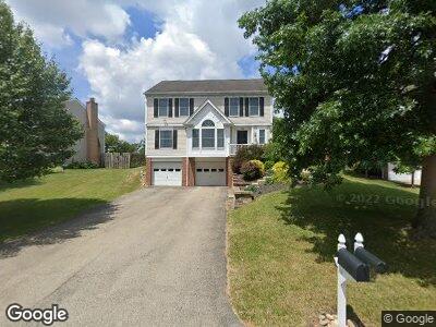
136 Trotwood Dr Canonsburg, PA 15317
Estimated Value: $255,544 - $289,000
3
Beds
3
Baths
1,470
Sq Ft
$182/Sq Ft
Est. Value
About This Home
This home is located at 136 Trotwood Dr, Canonsburg, PA 15317 and is currently estimated at $267,886, approximately $182 per square foot. 136 Trotwood Dr is a home located in Washington County with nearby schools including Canon-Mcmillan Senior High School, Central Christian Academy, and Central Christian Academy.
Ownership History
Date
Name
Owned For
Owner Type
Purchase Details
Closed on
Mar 21, 2011
Sold by
Blackhurst Jason A
Bought by
Blackhurst Ronald D
Current Estimated Value
Home Financials for this Owner
Home Financials are based on the most recent Mortgage that was taken out on this home.
Original Mortgage
$159,149
Interest Rate
5.07%
Mortgage Type
VA
Purchase Details
Closed on
Mar 16, 2001
Sold by
Mills Jeffrey A
Bought by
Blackhurst Jason A
Home Financials for this Owner
Home Financials are based on the most recent Mortgage that was taken out on this home.
Original Mortgage
$117,300
Interest Rate
6.93%
Create a Home Valuation Report for This Property
The Home Valuation Report is an in-depth analysis detailing your home's value as well as a comparison with similar homes in the area
Home Values in the Area
Average Home Value in this Area
Purchase History
| Date | Buyer | Sale Price | Title Company |
|---|---|---|---|
| Blackhurst Ronald D | $155,800 | -- | |
| Blackhurst Jason A | $118,250 | -- |
Source: Public Records
Mortgage History
| Date | Status | Borrower | Loan Amount |
|---|---|---|---|
| Open | Blackhurst Ronald D | $211,000 | |
| Closed | Blackhurst Ronald D | $173,566 | |
| Closed | Blackhurst Ronald D | $174,308 | |
| Closed | Blackhurst Ronald D | $180,000 | |
| Closed | Blackhurst Ronald D | $164,026 | |
| Closed | Blackhurst Ronald D | $164,998 | |
| Closed | Blackhurst Ronald D | $162,451 | |
| Closed | Blackhurst Ronald D | $161,132 | |
| Closed | Blackhurst Ronald D | $159,149 | |
| Previous Owner | Blackhurst Michelle L | $120,000 | |
| Previous Owner | Blackhurst Jason A | $117,300 |
Source: Public Records
Tax History Compared to Growth
Tax History
| Year | Tax Paid | Tax Assessment Tax Assessment Total Assessment is a certain percentage of the fair market value that is determined by local assessors to be the total taxable value of land and additions on the property. | Land | Improvement |
|---|---|---|---|---|
| 2024 | $2,614 | $163,800 | $30,500 | $133,300 |
| 2023 | $2,614 | $163,800 | $30,500 | $133,300 |
| 2022 | $2,607 | $163,800 | $30,500 | $133,300 |
| 2021 | $2,607 | $163,800 | $30,500 | $133,300 |
| 2020 | $2,475 | $163,800 | $30,500 | $133,300 |
| 2019 | $2,434 | $163,800 | $30,500 | $133,300 |
| 2018 | $2,383 | $163,800 | $30,500 | $133,300 |
| 2017 | $652 | $163,800 | $30,500 | $133,300 |
| 2016 | $652 | $18,695 | $2,587 | $16,108 |
| 2015 | $2,107 | $18,695 | $2,587 | $16,108 |
| 2014 | $680 | $18,695 | $2,587 | $16,108 |
| 2013 | $680 | $18,695 | $2,587 | $16,108 |
Source: Public Records
Map
Nearby Homes
- 5 Trotwood Cir
- 8 Pacers Ridge Dr
- 1045 Meadowbrook Dr
- 222 Hanover Ln
- 206 Hanover Ln
- 216 Hanover Ln
- 211 Coachside Dr
- 345 Hallam Ave
- 308 Cummins Ave
- 2226 Shawnee Dr
- 466 Hawthorn Hill Dr
- 509 Grapevine Ct
- 421 Hawthorn Hill Dr
- 416 Hawthorn Hill Dr
- 2292 Flint Dr
- 125 Black Oak Ln
- 203 Yellowwood Ct
- 205 Yellowwood Ct
- 207 Yellowwood Ct
- 211 Yellowwood Ct