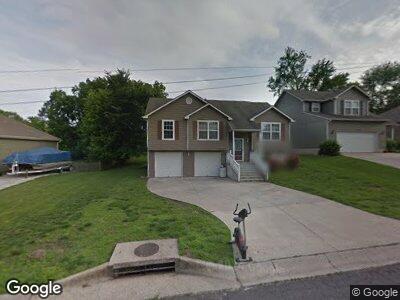
13733 Lawrence St Bonner Springs, KS 66012
Bonner-Loring NeighborhoodEstimated Value: $284,351 - $345,000
3
Beds
3
Baths
1,349
Sq Ft
$227/Sq Ft
Est. Value
About This Home
This home is located at 13733 Lawrence St, Bonner Springs, KS 66012 and is currently estimated at $306,088, approximately $226 per square foot. 13733 Lawrence St is a home located in Wyandotte County with nearby schools including Robert E Clark Middle School and Bonner Springs High School.
Ownership History
Date
Name
Owned For
Owner Type
Purchase Details
Closed on
Sep 26, 2003
Sold by
Johnson Jay W and Johnson Denise
Bought by
Blackwell Angela
Current Estimated Value
Home Financials for this Owner
Home Financials are based on the most recent Mortgage that was taken out on this home.
Original Mortgage
$139,000
Interest Rate
5.99%
Mortgage Type
Purchase Money Mortgage
Create a Home Valuation Report for This Property
The Home Valuation Report is an in-depth analysis detailing your home's value as well as a comparison with similar homes in the area
Home Values in the Area
Average Home Value in this Area
Purchase History
| Date | Buyer | Sale Price | Title Company |
|---|---|---|---|
| Blackwell Angela | -- | Guarantee Title |
Source: Public Records
Mortgage History
| Date | Status | Borrower | Loan Amount |
|---|---|---|---|
| Open | Blackwell Angela | $171,000 | |
| Closed | Blackwell Angela | $151,068 | |
| Closed | Balckwell Angela | $137,000 | |
| Closed | Blackwell Angela | $125,700 | |
| Closed | Blackwell Angela | $118,650 | |
| Closed | Blackwell Angela M | $132,000 | |
| Closed | Blackwell Angela M | $16,500 | |
| Closed | Blackwell Angela | $139,000 |
Source: Public Records
Tax History Compared to Growth
Tax History
| Year | Tax Paid | Tax Assessment Tax Assessment Total Assessment is a certain percentage of the fair market value that is determined by local assessors to be the total taxable value of land and additions on the property. | Land | Improvement |
|---|---|---|---|---|
| 2024 | $4,648 | $32,017 | $4,543 | $27,474 |
| 2023 | $4,536 | $29,256 | $4,192 | $25,064 |
| 2022 | $4,087 | $26,082 | $3,819 | $22,263 |
| 2021 | $3,586 | $21,587 | $3,143 | $18,444 |
| 2020 | $3,464 | $20,958 | $2,666 | $18,292 |
| 2019 | $3,329 | $19,959 | $2,469 | $17,490 |
| 2018 | $3,126 | $19,006 | $2,735 | $16,271 |
| 2017 | $3,082 | $19,067 | $2,735 | $16,332 |
| 2016 | $3,081 | $19,071 | $2,735 | $16,336 |
| 2015 | $3,083 | $19,071 | $2,744 | $16,327 |
| 2014 | $2,697 | $19,071 | $2,744 | $16,327 |
Source: Public Records
Map
Nearby Homes
- 13733 Lawrence Ave
- 13663 Barber Ave
- 13901 Harbor Dr
- 13111 Metropolitan Ave
- 13448 Metropolitan Ave
- 1138 S 138th St
- 149 S 142nd St
- 131 S Neconi Ave
- 146 Allcutt Ave
- 129 Kindred Ave
- 127 Kindred Ave
- 13139 Swartz Rd
- 209 W Front St
- 221 W Front St
- 926 S 130th Street Access Rd
- Lot 11 166th St
- 11801 State Ave
- 13701 Berger Ave
- 16501 148th St
- 15110 Linden Ct