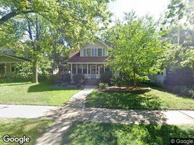
1380 Raymond Ave Saint Paul, MN 55108
Saint Anthony Park NeighborhoodEstimated Value: $509,000 - $630,000
4
Beds
3
Baths
2,274
Sq Ft
$253/Sq Ft
Est. Value
About This Home
This home is located at 1380 Raymond Ave, Saint Paul, MN 55108 and is currently estimated at $574,829, approximately $252 per square foot. 1380 Raymond Ave is a home located in Ramsey County with nearby schools including St. Anthony Park Elementary School, Murray Middle School, and Como Park Senior High School.
Ownership History
Date
Name
Owned For
Owner Type
Purchase Details
Closed on
Jan 24, 2023
Sold by
Pfaff Terry A
Bought by
Np328 Llc
Current Estimated Value
Purchase Details
Closed on
Jan 21, 2021
Sold by
Mcnattin Jennifer Lachenmayer
Bought by
Mcnattin Andrew E
Home Financials for this Owner
Home Financials are based on the most recent Mortgage that was taken out on this home.
Original Mortgage
$307,530
Interest Rate
2.67%
Mortgage Type
New Conventional
Purchase Details
Closed on
May 16, 2019
Sold by
Letourneau Joseph W and Letourneau Susan H
Bought by
Emsa Properties Llc
Purchase Details
Closed on
Oct 30, 2014
Sold by
Letourneau Joseph W and Letourneau Susan H
Bought by
Emsa Properties Llc
Create a Home Valuation Report for This Property
The Home Valuation Report is an in-depth analysis detailing your home's value as well as a comparison with similar homes in the area
Home Values in the Area
Average Home Value in this Area
Purchase History
| Date | Buyer | Sale Price | Title Company |
|---|---|---|---|
| Np328 Llc | $460,000 | Land Title | |
| Mcnattin Andrew E | -- | On Site Title | |
| Emsa Properties Llc | $80,000 | Land Title Inc | |
| Emsa Properties Llc | $80,000 | Land Title Inc |
Source: Public Records
Mortgage History
| Date | Status | Borrower | Loan Amount |
|---|---|---|---|
| Previous Owner | Mcnattin Andrew E | $307,530 | |
| Previous Owner | Mcnattin Andrew E | $386,054 | |
| Previous Owner | Mcnattin Andrew E | $379,950 | |
| Closed | Emsa Properties Llc | $0 |
Source: Public Records
Tax History Compared to Growth
Tax History
| Year | Tax Paid | Tax Assessment Tax Assessment Total Assessment is a certain percentage of the fair market value that is determined by local assessors to be the total taxable value of land and additions on the property. | Land | Improvement |
|---|---|---|---|---|
| 2023 | $7,988 | $515,900 | $116,800 | $399,100 |
| 2022 | $7,098 | $491,600 | $116,800 | $374,800 |
| 2021 | $7,202 | $438,800 | $116,800 | $322,000 |
| 2020 | $7,330 | $462,200 | $116,800 | $345,400 |
| 2019 | $7,370 | $436,600 | $116,800 | $319,800 |
| 2018 | $7,244 | $433,500 | $129,800 | $303,700 |
| 2017 | $6,798 | $438,600 | $129,800 | $308,800 |
| 2016 | $6,838 | $0 | $0 | $0 |
| 2015 | $6,890 | $412,300 | $114,200 | $298,100 |
| 2014 | $6,388 | $0 | $0 | $0 |
Source: Public Records
Map
Nearby Homes
- 1309 Raymond Ave
- 2250 W Luther Place Unit 101
- 1340 Keston St
- 1122 Raleigh St
- 2335 Buford Ave
- 2349 Commonwealth Ave
- 1666 Coffman St Unit 123
- 1666 Coffman St Unit 111
- 1666 Coffman St Unit 129
- 1666 Coffman St Unit 230
- 2370 Carter Ave
- 1656 Rose Hill Cir
- 1728 Pleasant St Unit H
- 1766 Pleasant St
- 1400 Snelling Ave N
- 2351 Bayless Place
- 1927 Autumn St
- 1383 Simpson St
- 1831 Malvern St
- 1516 Arona St