Estimated Value: $315,000 - $350,000
3
Beds
2
Baths
1,600
Sq Ft
$207/Sq Ft
Est. Value
About This Home
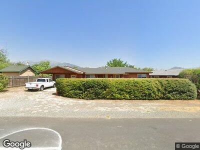
This home is located at 13990 S Fork Rd, Igo, CA 96047 and is currently estimated at $331,211, approximately $207 per square foot. 13990 S Fork Rd is a home located in Shasta County with nearby schools including Shasta High School.
Ownership History
Date
Name
Owned For
Owner Type
Purchase Details
Closed on
Dec 17, 2002
Sold by
Harris Michael P
Bought by
Mchugh Roderick N and Mchugh Katherine S
Current Estimated Value
Home Financials for this Owner
Home Financials are based on the most recent Mortgage that was taken out on this home.
Original Mortgage
$127,200
Interest Rate
6.03%
Mortgage Type
Purchase Money Mortgage
Purchase Details
Closed on
Jun 1, 2000
Sold by
Micoch Mark
Bought by
Harris Michael P
Purchase Details
Closed on
May 5, 2000
Sold by
Davison James Trenton and Shumaker Davison Jessica
Bought by
Micoch Mark
Purchase Details
Closed on
Sep 16, 1999
Sold by
Alberta Davison
Bought by
Davison James Trenton
Create a Home Valuation Report for This Property
The Home Valuation Report is an in-depth analysis detailing your home's value as well as a comparison with similar homes in the area
Home Values in the Area
Average Home Value in this Area
Purchase History
| Date | Buyer | Sale Price | Title Company |
|---|---|---|---|
| Mchugh Roderick N | $159,000 | Alliance Title Company | |
| Harris Michael P | $26,000 | Alliance Title Company | |
| Nicoch Mark | -- | Alliance Title Company | |
| Micoch Mark | $20,000 | Alliance Title Company | |
| Davison James Trenton | -- | -- |
Source: Public Records
Mortgage History
| Date | Status | Borrower | Loan Amount |
|---|---|---|---|
| Open | Mchugh Roderick N | $223,200 | |
| Closed | Mchugh Roderick N | $240,000 | |
| Closed | Mchugh Roderick N | $51,000 | |
| Closed | Mchugh Roderick N | $127,200 |
Source: Public Records
Tax History Compared to Growth
Tax History
| Year | Tax Paid | Tax Assessment Tax Assessment Total Assessment is a certain percentage of the fair market value that is determined by local assessors to be the total taxable value of land and additions on the property. | Land | Improvement |
|---|---|---|---|---|
| 2024 | $2,295 | $225,749 | $35,487 | $190,262 |
| 2023 | $2,295 | $221,324 | $34,792 | $186,532 |
| 2022 | $2,236 | $216,985 | $34,110 | $182,875 |
| 2021 | $2,189 | $212,732 | $33,442 | $179,290 |
| 2020 | $1,607 | $155,000 | $45,000 | $110,000 |
| 2019 | $1,596 | $155,000 | $45,000 | $110,000 |
| 2018 | $1,611 | $155,000 | $45,000 | $110,000 |
| 2017 | $1,623 | $155,000 | $45,000 | $110,000 |
| 2016 | $1,563 | $155,000 | $45,000 | $110,000 |
| 2015 | $1,491 | $148,000 | $45,000 | $103,000 |
| 2014 | -- | $148,000 | $45,000 | $103,000 |
Source: Public Records
Map
Nearby Homes
- 14539 Clear Creek Knolls Dr
- 0 Zogg Mine Unit 23-1981
- 7257 Deck Way
- 8703 Muletown Rd
- 6842 Nedra Ln
- 7741 Placer Rd
- 14055 Marsha Way
- 14124 Marsha Way
- 15093 Sunshine Ridge
- 14283 Marsha Way
- 14350 Lost Ln
- 0 Middletown Park Dr
- 15000 Middletown Park Dr
- 15090 Middletown Park Dr
- 15223 Ledgewood Dr
- 15028 Middletown Park Dr
- 15384 Prospect Dr
- 0 Cloverdale Rd
- 15333 Mountain Shadows Dr
- 8664 Landmark Cir