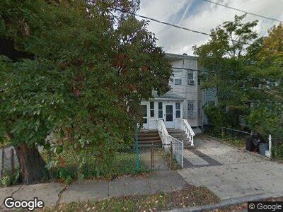
1415 Minton St Far Rockaway, NY 11691
Far Rockaway NeighborhoodEstimated Value: $550,753 - $593,000
--
Bed
--
Bath
1,172
Sq Ft
$486/Sq Ft
Est. Value
About This Home
This home is located at 1415 Minton St, Far Rockaway, NY 11691 and is currently estimated at $569,938, approximately $486 per square foot. 1415 Minton St is a home located in Queens County with nearby schools including The Randolph Holder School for Social Justice - Q253, P.S. 253 The Magnet School of Multicultural Humanities, and Ms 53 Brian Piccolo.
Ownership History
Date
Name
Owned For
Owner Type
Purchase Details
Closed on
Dec 9, 2009
Sold by
Pacheco Cindy
Bought by
Glucksman Feige D and Mezei Joel
Current Estimated Value
Home Financials for this Owner
Home Financials are based on the most recent Mortgage that was taken out on this home.
Original Mortgage
$240,000
Outstanding Balance
$162,921
Interest Rate
5%
Mortgage Type
Purchase Money Mortgage
Estimated Equity
$413,719
Create a Home Valuation Report for This Property
The Home Valuation Report is an in-depth analysis detailing your home's value as well as a comparison with similar homes in the area
Home Values in the Area
Average Home Value in this Area
Purchase History
| Date | Buyer | Sale Price | Title Company |
|---|---|---|---|
| Glucksman Feige D | $300,000 | -- |
Source: Public Records
Mortgage History
| Date | Status | Borrower | Loan Amount |
|---|---|---|---|
| Open | Glucksman Feige D | $7,013 | |
| Open | Glucksman Feige D | $240,000 |
Source: Public Records
Tax History Compared to Growth
Tax History
| Year | Tax Paid | Tax Assessment Tax Assessment Total Assessment is a certain percentage of the fair market value that is determined by local assessors to be the total taxable value of land and additions on the property. | Land | Improvement |
|---|---|---|---|---|
| 2024 | $3,108 | $15,475 | $2,207 | $13,268 |
| 2023 | $3,108 | $15,475 | $2,305 | $13,170 |
| 2022 | $2,766 | $29,520 | $4,800 | $24,720 |
| 2021 | $2,742 | $24,900 | $4,800 | $20,100 |
| 2020 | $2,592 | $21,420 | $4,800 | $16,620 |
| 2019 | $2,405 | $19,260 | $4,800 | $14,460 |
| 2018 | $2,331 | $12,896 | $2,751 | $10,145 |
| 2017 | $2,299 | $12,746 | $2,938 | $9,808 |
| 2016 | $2,095 | $12,746 | $2,938 | $9,808 |
| 2015 | $1,231 | $11,370 | $4,907 | $6,463 |
| 2014 | $1,231 | $10,747 | $4,638 | $6,109 |
Source: Public Records
Map
Nearby Homes
- 1260 Central Ave
- 12-99 Brunswick Ave
- 13-03 Brunswick Ave
- 15-20 Beach 12th St
- 11-52 Neilson St
- 24 Redfern Ave
- 31 Monroe St
- 1156 Beach 9th St
- 44 Monroe St
- 13-96 Beach Channel Dr
- 39 Alvin Place
- 2215 Nameoke Ave
- 344 Bayview Ave
- 10-40 Neilson St Unit 5M
- 1040 Neilson St Unit 2A
- 1040 Neilson St Unit 1A
- 802 Empire Ave
- 13-58 Pinson St
- 109 Jeanette Ave
- 13-58 Chandler St