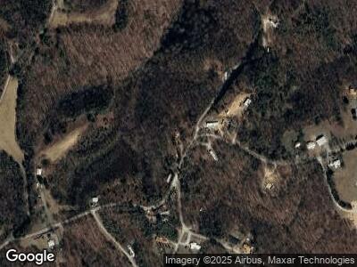
1419 Poss Rd Smithville, TN 37166
Estimated Value: $88,000 - $234,000
3
Beds
2
Baths
1,705
Sq Ft
$81/Sq Ft
Est. Value
About This Home
This home is located at 1419 Poss Rd, Smithville, TN 37166 and is currently estimated at $137,431, approximately $80 per square foot. 1419 Poss Rd is a home located in DeKalb County.
Ownership History
Date
Name
Owned For
Owner Type
Purchase Details
Closed on
May 26, 2015
Sold by
Storie James
Bought by
Storie James
Current Estimated Value
Purchase Details
Closed on
Jun 25, 2008
Sold by
Hud
Bought by
Storle James
Purchase Details
Closed on
Dec 28, 2007
Sold by
Tennessee Housing Devl Age
Purchase Details
Closed on
Aug 29, 2007
Sold by
Merriman Jake R
Bought by
Tennessee Housing Development
Purchase Details
Closed on
May 23, 2006
Sold by
Knowles Eston
Bought by
Merriamn Jake R and Merriamn Hope N
Home Financials for this Owner
Home Financials are based on the most recent Mortgage that was taken out on this home.
Original Mortgage
$54,568
Interest Rate
6.5%
Mortgage Type
New Conventional
Purchase Details
Closed on
Dec 17, 2001
Bought by
Bombardier Capital Inc
Purchase Details
Closed on
Sep 25, 1998
Sold by
Carver Kenneth R
Bought by
Adcox Richard L and Adcox Lisa G
Purchase Details
Closed on
Jul 21, 1998
Bought by
Trustee Management Co Llc
Create a Home Valuation Report for This Property
The Home Valuation Report is an in-depth analysis detailing your home's value as well as a comparison with similar homes in the area
Home Values in the Area
Average Home Value in this Area
Purchase History
| Date | Buyer | Sale Price | Title Company |
|---|---|---|---|
| Storie James | -- | -- | |
| Storle James | $34,000 | -- | |
| -- | $57,835 | -- | |
| Tennessee Housing Development | $57,835 | -- | |
| Merriamn Jake R | $55,000 | -- | |
| Bombardier Capital Inc | $33,000 | -- | |
| Adcox Richard L | $12,000 | -- | |
| Trustee Management Co Llc | $72,300 | -- |
Source: Public Records
Mortgage History
| Date | Status | Borrower | Loan Amount |
|---|---|---|---|
| Previous Owner | Trustee Management Co Llc | $54,568 |
Source: Public Records
Tax History Compared to Growth
Tax History
| Year | Tax Paid | Tax Assessment Tax Assessment Total Assessment is a certain percentage of the fair market value that is determined by local assessors to be the total taxable value of land and additions on the property. | Land | Improvement |
|---|---|---|---|---|
| 2024 | $31 | $1,250 | $1,250 | $0 |
| 2023 | $25 | $1,250 | $1,250 | $0 |
| 2022 | $22 | $1,250 | $1,250 | $0 |
| 2021 | $22 | $1,250 | $1,250 | $0 |
| 2020 | $25 | $1,250 | $1,250 | $0 |
| 2019 | $166 | $7,825 | $1,200 | $6,625 |
| 2018 | $143 | $7,825 | $1,200 | $6,625 |
| 2017 | $143 | $7,825 | $1,200 | $6,625 |
| 2016 | $143 | $7,825 | $1,200 | $6,625 |
| 2015 | $127 | $7,825 | $1,200 | $6,625 |
| 2014 | $177 | $10,925 | $1,200 | $9,725 |
| 2013 | $168 | $10,375 | $1,200 | $9,175 |
Source: Public Records
Map
Nearby Homes
- 0 Four Star Point
- 1142 Poss Rd
- 1413 Poss Rd
- 0 Stacey Rd Unit RTC2819082
- 0 4 Seasons Rd
- 292 Red Bud Dr
- 0 Fish Hook Dr Unit RTC2820174
- 0 Fish Hook Dr Unit RTC2820171
- 27 Opal Point Dr
- 1171 Hutchins Bend Rd
- 0 Sunset Pointe
- 4255 Sparta Hwy
- 2 Sunrise Point
- 1090 Fairways Dr
- 424 Watercolor Dr
- 685 Young Green Rd
- Lot 9 Watercolor Dr
- 0 Watercolor Dr
- 1.96 Ac Watercolor Dr
- 0 Moonlight Bay Dr Unit 235227
