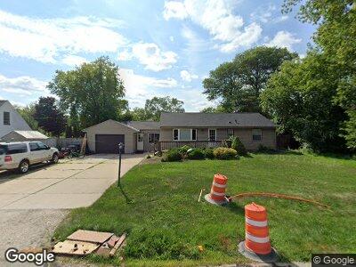
1425 S Rock Place New Berlin, WI 53151
Estimated Value: $271,000 - $334,000
3
Beds
1
Bath
1,262
Sq Ft
$242/Sq Ft
Est. Value
About This Home
This home is located at 1425 S Rock Place, New Berlin, WI 53151 and is currently estimated at $305,220, approximately $241 per square foot. 1425 S Rock Place is a home located in Waukesha County with nearby schools including Orchard Lane Elementary School, New Berlin West Middle/High School, and Mary Queen of Saints Catholic Academy.
Ownership History
Date
Name
Owned For
Owner Type
Purchase Details
Closed on
Apr 16, 2008
Sold by
Fagan Jodie D
Bought by
Fagan Michael P
Current Estimated Value
Purchase Details
Closed on
Jan 8, 1996
Sold by
Wene Robert F and Wene Kathleen
Bought by
Fagan Michael P and Fagan Jodie D
Home Financials for this Owner
Home Financials are based on the most recent Mortgage that was taken out on this home.
Original Mortgage
$101,150
Interest Rate
7.36%
Mortgage Type
Purchase Money Mortgage
Create a Home Valuation Report for This Property
The Home Valuation Report is an in-depth analysis detailing your home's value as well as a comparison with similar homes in the area
Home Values in the Area
Average Home Value in this Area
Purchase History
| Date | Buyer | Sale Price | Title Company |
|---|---|---|---|
| Fagan Michael P | -- | None Available | |
| Fagan Michael P | $106,500 | -- |
Source: Public Records
Mortgage History
| Date | Status | Borrower | Loan Amount |
|---|---|---|---|
| Open | Fagan Michael P | $150,750 | |
| Closed | Fagan Michael P | $30,150 | |
| Closed | Fagan Michael P | $101,150 |
Source: Public Records
Tax History Compared to Growth
Tax History
| Year | Tax Paid | Tax Assessment Tax Assessment Total Assessment is a certain percentage of the fair market value that is determined by local assessors to be the total taxable value of land and additions on the property. | Land | Improvement |
|---|---|---|---|---|
| 2024 | $3,101 | $255,100 | $54,000 | $201,100 |
| 2023 | $3,132 | $199,800 | $48,300 | $151,500 |
| 2022 | $3,208 | $199,800 | $48,300 | $151,500 |
| 2021 | $3,049 | $199,800 | $48,300 | $151,500 |
| 2020 | $3,050 | $199,800 | $48,300 | $151,500 |
| 2019 | $4,217 | $199,800 | $48,300 | $151,500 |
| 2018 | $3,462 | $199,800 | $48,300 | $151,500 |
| 2017 | $3,261 | $185,900 | $43,000 | $142,900 |
| 2016 | $3,300 | $185,900 | $43,000 | $142,900 |
| 2015 | $3,276 | $185,900 | $43,000 | $142,900 |
| 2014 | $3,098 | $172,800 | $40,000 | $132,800 |
| 2013 | $3,098 | $172,800 | $40,000 | $132,800 |
Source: Public Records
Map
Nearby Homes
- 13818 W Meadow Ln
- 1055 S Sunny Slope Rd
- 13012 W Meadow Ln
- 1941 S 124th St
- 15255 Casey Cir Unit 131
- 15250 Huff Way
- 15070 Franklin Dr Unit Lot 1
- 14655 W Meadowshire Dr
- 812 S 121st St
- 220 Sheffield Dr
- 235 N Elm Grove Rd Unit C
- 2380 S Root River Pkwy
- 245 N Elmridge Ave
- 13202 W Cleveland Ave
- 32 S 116th St
- 1615 S 115th Ct Unit 4
- Lt0 Golf Pkwy
- 179 N 123rd St
- 14225 Twilight Way Unit 60
- 12990 W Bluemound Rd Unit 303