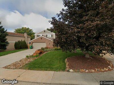
1431 E Long Place Centennial, CO 80122
South Littleton NeighborhoodEstimated Value: $653,000 - $673,000
4
Beds
3
Baths
2,402
Sq Ft
$275/Sq Ft
Est. Value
About This Home
This home is located at 1431 E Long Place, Centennial, CO 80122 and is currently estimated at $660,934, approximately $275 per square foot. 1431 E Long Place is a home located in Arapahoe County with nearby schools including John Wesley Powell Middle School, Arapahoe High School, and Mile High Academy.
Ownership History
Date
Name
Owned For
Owner Type
Purchase Details
Closed on
Dec 20, 2002
Sold by
Toth Robert G and Mcgillvray Joanne E
Bought by
Strobel Bartt L
Current Estimated Value
Home Financials for this Owner
Home Financials are based on the most recent Mortgage that was taken out on this home.
Original Mortgage
$235,100
Interest Rate
6.05%
Purchase Details
Closed on
Apr 9, 1999
Sold by
Nielsen Kurt C
Bought by
Toth Robert G and Mcgillvray Joanne E
Home Financials for this Owner
Home Financials are based on the most recent Mortgage that was taken out on this home.
Original Mortgage
$183,671
Interest Rate
7.06%
Mortgage Type
FHA
Purchase Details
Closed on
Apr 17, 1996
Sold by
Glen C Nielsen Trust
Bought by
Nielsen Kurt C
Home Financials for this Owner
Home Financials are based on the most recent Mortgage that was taken out on this home.
Original Mortgage
$144,000
Interest Rate
8.25%
Purchase Details
Closed on
Aug 31, 1995
Sold by
Mathiowetz Thomas M and Mathiowetz Jeanne M
Bought by
Glen C Nielsen Trust
Purchase Details
Closed on
Oct 21, 1994
Sold by
Kirk Douglas D and Kirk Susan L
Bought by
Mathiowetz Thomas M and Mathiowetz Jeanne M
Home Financials for this Owner
Home Financials are based on the most recent Mortgage that was taken out on this home.
Original Mortgage
$123,200
Interest Rate
8.5%
Purchase Details
Closed on
Mar 26, 1993
Sold by
Stafiej Stanley J
Bought by
Kirk Douglas D Kirk Susan L
Purchase Details
Closed on
Sep 24, 1991
Sold by
Morrill Ronald F Morrill Sherilyn A
Bought by
Stafiej Stanley J
Purchase Details
Closed on
Nov 20, 1990
Sold by
Conversion Arapco
Bought by
Morrill Ronald F Morrill Sherilyn A
Purchase Details
Closed on
Jun 1, 1985
Sold by
Conversion Arapco
Bought by
Conversion Arapco
Purchase Details
Closed on
Mar 1, 1979
Sold by
Conversion Arapco
Bought by
Conversion Arapco
Purchase Details
Closed on
Jul 4, 1776
Bought by
Conversion Arapco
Create a Home Valuation Report for This Property
The Home Valuation Report is an in-depth analysis detailing your home's value as well as a comparison with similar homes in the area
Home Values in the Area
Average Home Value in this Area
Purchase History
| Date | Buyer | Sale Price | Title Company |
|---|---|---|---|
| Strobel Bartt L | $247,500 | Land Title Guarantee Company | |
| Toth Robert G | $184,900 | -- | |
| Nielsen Kurt C | $160,000 | -- | |
| Glen C Nielsen Trust | $157,750 | Land Title | |
| Mathiowetz Thomas M | $154,000 | Land Title | |
| Kirk Douglas D Kirk Susan L | -- | -- | |
| Stafiej Stanley J | -- | -- | |
| Morrill Ronald F Morrill Sherilyn A | -- | -- | |
| Conversion Arapco | -- | -- | |
| Conversion Arapco | -- | -- | |
| Conversion Arapco | -- | -- |
Source: Public Records
Mortgage History
| Date | Status | Borrower | Loan Amount |
|---|---|---|---|
| Open | Strobel Bartt L | $262,000 | |
| Closed | Strobel Bartt L | $263,000 | |
| Closed | Strobel Bartt L | $208,000 | |
| Closed | Strobel Bartt L | $31,000 | |
| Closed | Strobel Bartt L | $235,100 | |
| Previous Owner | Toth Robert G | $217,000 | |
| Previous Owner | Toth Robert G | $21,800 | |
| Previous Owner | Toth Robert G | $183,671 | |
| Previous Owner | Nielsen Kurt C | $144,000 | |
| Previous Owner | Mathiowetz Thomas M | $123,200 |
Source: Public Records
Tax History Compared to Growth
Tax History
| Year | Tax Paid | Tax Assessment Tax Assessment Total Assessment is a certain percentage of the fair market value that is determined by local assessors to be the total taxable value of land and additions on the property. | Land | Improvement |
|---|---|---|---|---|
| 2024 | $3,982 | $37,125 | -- | -- |
| 2023 | $3,982 | $37,125 | $0 | $0 |
| 2022 | $3,662 | $32,158 | $0 | $0 |
| 2021 | $3,659 | $32,158 | $0 | $0 |
| 2020 | $3,506 | $31,675 | $0 | $0 |
| 2019 | $3,317 | $31,675 | $0 | $0 |
| 2018 | $2,891 | $27,734 | $0 | $0 |
| 2017 | $2,668 | $27,734 | $0 | $0 |
| 2016 | $2,386 | $23,864 | $0 | $0 |
| 2015 | $2,389 | $23,864 | $0 | $0 |
| 2014 | -- | $19,534 | $0 | $0 |
| 2013 | -- | $18,310 | $0 | $0 |
Source: Public Records
Map
Nearby Homes
- 1576 E Mineral Ave
- 1348 E Jamison Ave
- 7923 S Marion Ct
- 1392 E Nichols Ave
- 7926 S Corona Ct
- 7624 S Race St
- 2043 E Nichols Dr
- 7744 S Gaylord Way
- 7604 S Vine St
- 7488 S Lafayette Cir E
- 7946 S Pennsylvania Ct
- 7391 S Marion St
- 7974 S Pennsylvania Dr
- 7546 S Penrose Ct
- 2357 E Mineral Ave
- 7852 S Logan St
- 668 E Dry Creek Cir
- 7841 S Logan St
- 7791 S Columbine St
- 2067 E Phillips Place