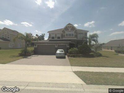
14524 Tabago Bay Dr Winter Garden, FL 34787
Estimated Value: $752,000 - $801,000
4
Beds
4
Baths
2,787
Sq Ft
$277/Sq Ft
Est. Value
About This Home
This home is located at 14524 Tabago Bay Dr, Winter Garden, FL 34787 and is currently estimated at $771,270, approximately $276 per square foot. 14524 Tabago Bay Dr is a home located in Orange County with nearby schools including Sunridge Elementary, Sunridge Middle School, and West Orange High School.
Ownership History
Date
Name
Owned For
Owner Type
Purchase Details
Closed on
Apr 29, 2010
Sold by
Lievano Ricardo A and Lievano Jennifer
Bought by
Mccleary Michael D and Mccleary Jessica C
Current Estimated Value
Home Financials for this Owner
Home Financials are based on the most recent Mortgage that was taken out on this home.
Original Mortgage
$417,000
Interest Rate
4.99%
Mortgage Type
New Conventional
Purchase Details
Closed on
Apr 19, 2004
Sold by
Landstar Development Corp
Bought by
Lievano Ricardo A and Lievano Jennifer
Home Financials for this Owner
Home Financials are based on the most recent Mortgage that was taken out on this home.
Original Mortgage
$274,872
Interest Rate
5.36%
Mortgage Type
Balloon
Create a Home Valuation Report for This Property
The Home Valuation Report is an in-depth analysis detailing your home's value as well as a comparison with similar homes in the area
Home Values in the Area
Average Home Value in this Area
Purchase History
| Date | Buyer | Sale Price | Title Company |
|---|---|---|---|
| Mccleary Michael D | $440,000 | Sunbelt Title Agency | |
| Lievano Ricardo A | $343,600 | -- |
Source: Public Records
Mortgage History
| Date | Status | Borrower | Loan Amount |
|---|---|---|---|
| Open | Mccleary Michael D | $405,600 | |
| Closed | Mccleary Michael D | $381,700 | |
| Closed | Mccleary Michael D | $417,000 | |
| Previous Owner | Lievano Ricardo A | $35,500 | |
| Previous Owner | Lievano Ricardo A | $274,872 |
Source: Public Records
Tax History Compared to Growth
Tax History
| Year | Tax Paid | Tax Assessment Tax Assessment Total Assessment is a certain percentage of the fair market value that is determined by local assessors to be the total taxable value of land and additions on the property. | Land | Improvement |
|---|---|---|---|---|
| 2024 | $5,174 | $387,002 | -- | -- |
| 2023 | $5,174 | $365,141 | $0 | $0 |
| 2022 | $5,024 | $354,506 | $0 | $0 |
| 2021 | $4,953 | $344,181 | $0 | $0 |
| 2020 | $4,720 | $339,429 | $0 | $0 |
| 2019 | $4,872 | $331,798 | $0 | $0 |
| 2018 | $4,831 | $325,611 | $0 | $0 |
| 2017 | $4,705 | $370,652 | $100,000 | $270,652 |
| 2016 | $4,697 | $333,719 | $70,000 | $263,719 |
| 2015 | $4,779 | $359,657 | $65,000 | $294,657 |
| 2014 | $4,812 | $341,960 | $65,000 | $276,960 |
Source: Public Records
Map
Nearby Homes
- 14039 Hampshire Bay Cir
- 14315 Hampshire Bay Cir
- 15049 Canopy Cover Dr
- 17858 Adrift Rd
- 16560 Point Rock Dr
- 526 First Cape Coral Dr
- 523 Cascading Creek Ln
- 14157 Creekbed Cir
- 14001 Jomatt Loop
- 2510 Black Lake Blvd
- 2806 Balforn Tower Way
- 14401 Black Lake Preserve St
- 13412 Fox Glove St
- 14130 Jomatt Loop
- 14031 Jomatt Loop
- 14504 Sunbridge Cir
- 387 Winter Nellis Cir
- 14372 Sunbridge Cir
- 13144 Social Ln
- 339 Winter Nellis Cir