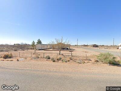
14610 Simpson Rd El Paso, TX 79938
Estimated Value: $97,000 - $452,000
2
Beds
1
Bath
1,024
Sq Ft
$204/Sq Ft
Est. Value
About This Home
This home is located at 14610 Simpson Rd, El Paso, TX 79938 and is currently estimated at $208,612, approximately $203 per square foot. 14610 Simpson Rd is a home located in El Paso County with nearby schools including Red Sands Elementary School, East Montana Middle School, and Mountain View High School.
Ownership History
Date
Name
Owned For
Owner Type
Purchase Details
Closed on
Jan 12, 2024
Sold by
Lulu Lots Llc
Bought by
Gm Simpson Texas Realty Llc
Current Estimated Value
Home Financials for this Owner
Home Financials are based on the most recent Mortgage that was taken out on this home.
Original Mortgage
$87,300
Outstanding Balance
$86,482
Interest Rate
6.95%
Mortgage Type
New Conventional
Estimated Equity
$55,784
Purchase Details
Closed on
Jan 11, 2024
Sold by
Candelaria Lisa
Bought by
Lulu Lots Llc
Home Financials for this Owner
Home Financials are based on the most recent Mortgage that was taken out on this home.
Original Mortgage
$87,300
Outstanding Balance
$86,482
Interest Rate
6.95%
Mortgage Type
New Conventional
Estimated Equity
$55,784
Purchase Details
Closed on
Aug 16, 2007
Sold by
Sotelo Marcos A and City Of El Paso
Bought by
M J Real Properties
Create a Home Valuation Report for This Property
The Home Valuation Report is an in-depth analysis detailing your home's value as well as a comparison with similar homes in the area
Home Values in the Area
Average Home Value in this Area
Purchase History
| Date | Buyer | Sale Price | Title Company |
|---|---|---|---|
| Gm Simpson Texas Realty Llc | -- | None Listed On Document | |
| Lulu Lots Llc | -- | None Listed On Document | |
| M J Real Properties | $13,700 | None Available |
Source: Public Records
Mortgage History
| Date | Status | Borrower | Loan Amount |
|---|---|---|---|
| Open | Gm Simpson Texas Realty Llc | $87,300 |
Source: Public Records
Tax History Compared to Growth
Tax History
| Year | Tax Paid | Tax Assessment Tax Assessment Total Assessment is a certain percentage of the fair market value that is determined by local assessors to be the total taxable value of land and additions on the property. | Land | Improvement |
|---|---|---|---|---|
| 2023 | $459 | $53,711 | $0 | $0 |
| 2022 | $1,074 | $48,828 | $0 | $0 |
| 2021 | $1,059 | $54,016 | $19,436 | $34,580 |
| 2020 | $929 | $40,354 | $19,436 | $20,918 |
| 2018 | $953 | $40,637 | $19,436 | $21,201 |
| 2017 | $892 | $38,373 | $19,436 | $18,937 |
| 2016 | $1,607 | $69,181 | $13,605 | $55,576 |
| 2015 | $962 | $41,392 | $13,605 | $27,787 |
| 2014 | $962 | $43,027 | $13,605 | $29,422 |
Source: Public Records
Map
Nearby Homes
- 0 Van Fleet Rd
- 14401 Simpson Rd
- 14773 Van Fleet Rd
- 14572 Jim Bridger Rd
- 14472 Gruenther Rd
- 14697 Jim Bridger Rd
- 5401 Ch Hunton St
- 5340 Buffalo Creek Dr
- 4761 Cruz Tierra St
- TBD Cruz Tierra St
- 4799 Cruz Tierra St
- 4990 Cruz Tierra St
- 4421 Cruz Tierra St
- 14400 Eichelberger Ave
- 14430 Eichelberger Ave
- 4831 Betts Dr
- 4798 Fort Selden St
- 14097 Silver Spur St
- 5650 Wagon Wheel Cir
- 4920 Fort Defiance Dr