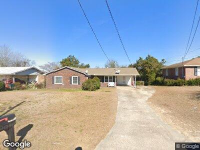
1469 Berkshire Dr Macon, GA 31206
Estimated Value: $94,346 - $133,000
3
Beds
2
Baths
1,252
Sq Ft
$92/Sq Ft
Est. Value
About This Home
This home is located at 1469 Berkshire Dr, Macon, GA 31206 and is currently estimated at $115,337, approximately $92 per square foot. 1469 Berkshire Dr is a home located in Bibb County with nearby schools including Hartley Elementary School, Southwest High School, and Cirrus Charter Academy.
Ownership History
Date
Name
Owned For
Owner Type
Purchase Details
Closed on
Jun 9, 2011
Sold by
Secretary Of Housing & Urban Development
Bought by
Jackson Moses
Current Estimated Value
Home Financials for this Owner
Home Financials are based on the most recent Mortgage that was taken out on this home.
Original Mortgage
$22,800
Interest Rate
4.53%
Mortgage Type
Future Advance Clause Open End Mortgage
Purchase Details
Closed on
Oct 5, 2010
Sold by
Blount Dorish S
Bought by
Wells Fargo Bank Na
Create a Home Valuation Report for This Property
The Home Valuation Report is an in-depth analysis detailing your home's value as well as a comparison with similar homes in the area
Home Values in the Area
Average Home Value in this Area
Purchase History
| Date | Buyer | Sale Price | Title Company |
|---|---|---|---|
| Jackson Moses | $28,600 | None Available | |
| Wells Fargo Bank Na | $111,800 | -- | |
| The Secretary Of Housing & Urban Develop | $111,829 | None Available | |
| Wells Fargo Bank Na | $111,828 | None Available |
Source: Public Records
Mortgage History
| Date | Status | Borrower | Loan Amount |
|---|---|---|---|
| Closed | Jackson Moses | $22,800 | |
| Previous Owner | Blount Dorish S | $106,151 | |
| Previous Owner | Blount Dorish S | $106,067 | |
| Previous Owner | Blount Dorish S | $10,000 | |
| Previous Owner | Blount Dorish S | $21,000 |
Source: Public Records
Tax History Compared to Growth
Tax History
| Year | Tax Paid | Tax Assessment Tax Assessment Total Assessment is a certain percentage of the fair market value that is determined by local assessors to be the total taxable value of land and additions on the property. | Land | Improvement |
|---|---|---|---|---|
| 2024 | $824 | $32,462 | $2,880 | $29,582 |
| 2023 | $824 | $32,462 | $2,880 | $29,582 |
| 2022 | $758 | $21,897 | $4,648 | $17,249 |
| 2021 | $832 | $21,897 | $4,648 | $17,249 |
| 2020 | $850 | $21,897 | $4,648 | $17,249 |
| 2019 | $857 | $21,897 | $4,648 | $17,249 |
| 2018 | $1,493 | $21,897 | $4,648 | $17,249 |
| 2017 | $820 | $21,897 | $4,648 | $17,249 |
| 2016 | $758 | $21,897 | $4,648 | $17,249 |
| 2015 | $1,072 | $21,897 | $4,648 | $17,249 |
| 2014 | $1,286 | $22,827 | $5,578 | $17,249 |
Source: Public Records
Map
Nearby Homes
- 3033 Manchester Dr
- 2831 Kent Dr
- 3046 Somerset Dr Unit 1
- 3047 Somerset Dr
- 3158 Brownell Ave
- 3082 Somerset Dr
- 1832 Sussex Dr
- 3420 Travis Blvd
- 2661 Pine Ave
- 1085 Jessamine St
- 1355 Harris St
- 2930 Margaret Dr
- 2436 Monroe Ave
- 2249 Lowe St
- 1616 Hurley Cir
- 1049 Anthony Rd
- 1045 Anthony Rd
- 3685 Rice Mill Rd
- 1620 Mathis Cir
- 1191 Carroll St