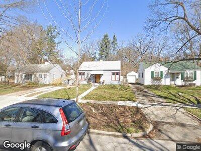
1507 South Blvd Ann Arbor, MI 48104
South Packard NeighborhoodEstimated Value: $267,281 - $376,000
--
Bed
--
Bath
672
Sq Ft
$509/Sq Ft
Est. Value
About This Home
This home is located at 1507 South Blvd, Ann Arbor, MI 48104 and is currently estimated at $342,070, approximately $509 per square foot. 1507 South Blvd is a home located in Washtenaw County with nearby schools including Pattengill Elementary School, Bryant Elementary School, and Tappan Middle School.
Ownership History
Date
Name
Owned For
Owner Type
Purchase Details
Closed on
May 30, 2003
Sold by
Hug Barbara
Bought by
Krull Marie Louise
Current Estimated Value
Home Financials for this Owner
Home Financials are based on the most recent Mortgage that was taken out on this home.
Original Mortgage
$150,300
Interest Rate
5.88%
Mortgage Type
Unknown
Purchase Details
Closed on
Aug 20, 1999
Sold by
Jeffreys Cynthia A
Bought by
Hug Barbara
Create a Home Valuation Report for This Property
The Home Valuation Report is an in-depth analysis detailing your home's value as well as a comparison with similar homes in the area
Home Values in the Area
Average Home Value in this Area
Purchase History
| Date | Buyer | Sale Price | Title Company |
|---|---|---|---|
| Krull Marie Louise | $167,000 | -- | |
| Hug Barbara | $115,000 | -- |
Source: Public Records
Mortgage History
| Date | Status | Borrower | Loan Amount |
|---|---|---|---|
| Open | Krull Marie L | $134,300 | |
| Closed | Krull Marie Louise | $150,300 |
Source: Public Records
Tax History Compared to Growth
Tax History
| Year | Tax Paid | Tax Assessment Tax Assessment Total Assessment is a certain percentage of the fair market value that is determined by local assessors to be the total taxable value of land and additions on the property. | Land | Improvement |
|---|---|---|---|---|
| 2024 | $3,861 | $101,400 | $0 | $0 |
| 2023 | $3,560 | $96,800 | $0 | $0 |
| 2022 | $3,879 | $101,000 | $0 | $0 |
| 2021 | $3,788 | $103,900 | $0 | $0 |
| 2020 | $3,711 | $102,100 | $0 | $0 |
| 2019 | $3,532 | $101,800 | $101,800 | $0 |
| 2018 | $3,482 | $99,400 | $0 | $0 |
| 2017 | $3,388 | $91,700 | $0 | $0 |
| 2016 | $3,268 | $67,744 | $0 | $0 |
| 2015 | $3,113 | $67,542 | $0 | $0 |
| 2014 | $3,113 | $65,433 | $0 | $0 |
| 2013 | -- | $65,433 | $0 | $0 |
Source: Public Records
Map
Nearby Homes
- 1905 Steere Place
- 1615 Ferndale Place
- 1282 Jewett Ave
- 1914 Crestland Dr
- 2401 Packard St Unit 31D
- 2401 Packard St Unit 33D
- 1304 Granger Ave
- 1835 Independence Blvd
- 1506 Golden Ave
- 1915 Scottwood Ave
- 1120 Granger Ave
- 1219 S Forest Ave
- 2134 Washtenaw Ave
- 2132 Washtenaw Ave
- 2010 Devonshire Rd
- 1015 Olivia Ave
- 1577 King George Blvd
- 2640 Gladstone Ave
- 929 Olivia Ave
- 2941 Kimberley Rd