1510 Moore St Unit 101 Bristol, PA 19007
Bristol Township NeighborhoodEstimated Value: $268,963 - $286,000
2
Beds
2
Baths
1,211
Sq Ft
$231/Sq Ft
Est. Value
About This Home
This home is located at 1510 Moore St Unit 101, Bristol, PA 19007 and is currently estimated at $279,241, approximately $230 per square foot. 1510 Moore St Unit 101 is a home located in Bucks County with nearby schools including Truman Senior High School, St. Mark Elementary School, and Isabet Academy.
Ownership History
Date
Name
Owned For
Owner Type
Purchase Details
Closed on
Apr 2, 2025
Sold by
Conti Frank J and Conti Denise A
Bought by
Kim Sung Woo and Kim In Ok
Current Estimated Value
Purchase Details
Closed on
Dec 13, 2017
Sold by
Rh Hearthstone L P
Bought by
Conti Frank J and Conti Denise A
Home Financials for this Owner
Home Financials are based on the most recent Mortgage that was taken out on this home.
Original Mortgage
$139,500
Interest Rate
3.9%
Mortgage Type
New Conventional
Purchase Details
Closed on
Dec 3, 2017
Sold by
Rh Heatrhsotne Lp
Bought by
Conti Frank J and Conti Denise A
Home Financials for this Owner
Home Financials are based on the most recent Mortgage that was taken out on this home.
Original Mortgage
$139,500
Interest Rate
3.9%
Mortgage Type
New Conventional
Create a Home Valuation Report for This Property
The Home Valuation Report is an in-depth analysis detailing your home's value as well as a comparison with similar homes in the area
Home Values in the Area
Average Home Value in this Area
Purchase History
| Date | Buyer | Sale Price | Title Company |
|---|---|---|---|
| Kim Sung Woo | $279,900 | None Listed On Document | |
| Conti Frank J | $158,175 | Security Abstract Of Pa Inc | |
| Conti Frank J | $153,175 | Security Abstract Of Pa Inc |
Source: Public Records
Mortgage History
| Date | Status | Borrower | Loan Amount |
|---|---|---|---|
| Previous Owner | Conti Frank J | $142,700 | |
| Previous Owner | Conti Frank J | $139,500 | |
| Previous Owner | Rh Hearthsone Lp | $3,187,800 |
Source: Public Records
Tax History Compared to Growth
Tax History
| Year | Tax Paid | Tax Assessment Tax Assessment Total Assessment is a certain percentage of the fair market value that is determined by local assessors to be the total taxable value of land and additions on the property. | Land | Improvement |
|---|---|---|---|---|
| 2024 | $3,639 | $13,400 | $0 | $13,400 |
| 2023 | $3,612 | $13,400 | $0 | $13,400 |
| 2022 | $3,612 | $13,400 | $0 | $13,400 |
| 2021 | $3,612 | $13,400 | $0 | $13,400 |
| 2020 | $3,612 | $13,400 | $0 | $13,400 |
| 2019 | $3,599 | $13,400 | $0 | $13,400 |
| 2018 | $0 | $0 | $0 | $0 |
| 2017 | $0 | $0 | $0 | $0 |
| 2016 | -- | $0 | $0 | $0 |
| 2015 | -- | $0 | $0 | $0 |
| 2014 | -- | $0 | $0 | $0 |
Source: Public Records
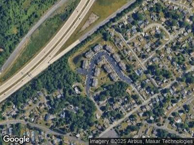
Map
Nearby Homes
- 1505 Moore St Unit 203
- 3300 Broadway Ave
- 1541 Mile St
- 1545 Mile St
- 1551 Mile St
- 1555 Mile St
- 3303 Glenrose Ave
- 1556 Mile St
- 2366 Maple Ave
- 3525 Rockview Dr
- 1719 Susan Ave
- 1712 Dixon Ave
- 1902 Spencer Dr
- 1717 Spencer Dr
- 1709 Spencer Dr
- 1303 Veterans Hwy
- 359 Dartmouth Ct Unit 359
- 3402 Spring Ave
- 3702 Elmhurst Ave
- L:15 Dunston Rd