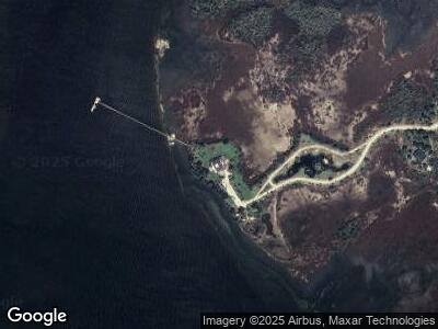
1512 Mariner Place Dr Mount Pleasant, SC 29466
Estimated Value: $2,951,000 - $4,031,255
4
Beds
6
Baths
9,700
Sq Ft
$360/Sq Ft
Est. Value
About This Home
This home is located at 1512 Mariner Place Dr, Mount Pleasant, SC 29466 and is currently estimated at $3,491,128, approximately $359 per square foot. 1512 Mariner Place Dr is a home located in Charleston County with nearby schools including Jennie Moore Elementary School, Laing Middle School, and Wando High School.
Ownership History
Date
Name
Owned For
Owner Type
Purchase Details
Closed on
Dec 21, 2021
Sold by
Loy Stewart David
Bought by
D Loy Stewart Trust
Current Estimated Value
Purchase Details
Closed on
Dec 20, 2021
Sold by
Family Trust
Bought by
Mariner Place Llc
Purchase Details
Closed on
Mar 3, 2021
Sold by
Stewart David Loy and Judy D Stewart Revocable Trust
Bought by
Stewart David Loy and Judy D Stewart Family Gst Exem
Purchase Details
Closed on
Feb 19, 2015
Sold by
Estate Of Judy D Stewart
Bought by
Stewart D Loy
Purchase Details
Closed on
Jul 2, 2004
Sold by
Stewart D Loy
Bought by
Stewart Judy D
Purchase Details
Closed on
Aug 6, 2001
Sold by
Stewart D Loy
Bought by
Stewart D Loy and Stewart Sharon C
Create a Home Valuation Report for This Property
The Home Valuation Report is an in-depth analysis detailing your home's value as well as a comparison with similar homes in the area
Home Values in the Area
Average Home Value in this Area
Purchase History
| Date | Buyer | Sale Price | Title Company |
|---|---|---|---|
| D Loy Stewart Trust | -- | None Listed On Document | |
| Mariner Place Llc | -- | None Listed On Document | |
| Family Trust | -- | None Listed On Document | |
| D Loy Stewart Trust | -- | None Listed On Document | |
| Stewart David Loy | -- | None Available | |
| Stewart D Loy | -- | -- | |
| Stewart Judy D | -- | -- | |
| Stewart D Loy | $215,000 | -- |
Source: Public Records
Mortgage History
| Date | Status | Borrower | Loan Amount |
|---|---|---|---|
| Previous Owner | Stewart David Loy | $4,000,000 | |
| Previous Owner | Stewart D Loy | $4,000,000 |
Source: Public Records
Tax History Compared to Growth
Tax History
| Year | Tax Paid | Tax Assessment Tax Assessment Total Assessment is a certain percentage of the fair market value that is determined by local assessors to be the total taxable value of land and additions on the property. | Land | Improvement |
|---|---|---|---|---|
| 2023 | $59,216 | $240,000 | $0 | $0 |
| 2022 | $54,728 | $240,000 | $0 | $0 |
| 2021 | $36,011 | $157,730 | $0 | $0 |
| 2020 | $35,543 | $157,730 | $0 | $0 |
| 2019 | $32,232 | $137,160 | $0 | $0 |
| 2017 | $30,974 | $137,160 | $0 | $0 |
| 2016 | $29,845 | $137,160 | $0 | $0 |
| 2015 | $8,782 | $91,440 | $0 | $0 |
| 2014 | $7,327 | $0 | $0 | $0 |
| 2011 | -- | $0 | $0 | $0 |
Source: Public Records
Map
Nearby Homes
- 2331 Kiln Point Dr
- 1905 Lone Oak Point
- 2504 Ballast Point
- 1954 Sandy Point Ln
- 2640 Crooked Stick Ln
- 2696 Crooked Stick Ln
- 2737 Sarazen Dr
- 1717 Rivertowne Country Club Dr
- 2722 Crooked Stick Ln
- 1999 N Creek Dr
- 1800 Palmetto Isle Dr
- 1821 Great Hope Dr
- 1896 Palmetto Isle Dr
- 2621 Ringsted Ln
- 2516 Willbrook Ln
- 1857 Palmetto Isle Dr
- 2340 Salt Wind Way
- 2156 Cheswick Ln
- 2732 Canebreak Ln
- 1742 Habersham
