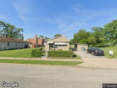
1526 Piggott Ave East Saint Louis, IL 62207
East Saint Louis NeighborhoodEstimated Value: $28,000 - $82,000
--
Bed
--
Bath
576
Sq Ft
$86/Sq Ft
Est. Value
About This Home
This home is located at 1526 Piggott Ave, East Saint Louis, IL 62207 and is currently estimated at $49,450, approximately $85 per square foot. 1526 Piggott Ave is a home located in St. Clair County with nearby schools including Dunbar Elementary School, East St Louis-Lincoln Middle School, and East St Louis Senior High School.
Ownership History
Date
Name
Owned For
Owner Type
Purchase Details
Closed on
Jul 2, 2020
Sold by
Ballard Cedric
Bought by
Edwards Althea and Ballard Quentin
Current Estimated Value
Purchase Details
Closed on
May 5, 2016
Sold by
Boullard Quentin
Bought by
Edwards Alethea and Ballard Cedric
Purchase Details
Closed on
Oct 12, 2012
Sold by
Edwards Alethea
Bought by
Ballard Quenton L
Purchase Details
Closed on
May 2, 2009
Sold by
Watts Fern
Bought by
Watts Janice and Edwards Glethea
Create a Home Valuation Report for This Property
The Home Valuation Report is an in-depth analysis detailing your home's value as well as a comparison with similar homes in the area
Home Values in the Area
Average Home Value in this Area
Purchase History
| Date | Buyer | Sale Price | Title Company |
|---|---|---|---|
| Edwards Althea | -- | None Available | |
| Edwards Alethea | -- | None Available | |
| Ballard Quenton L | -- | None Available | |
| Watts Janice | -- | None Available |
Source: Public Records
Mortgage History
| Date | Status | Borrower | Loan Amount |
|---|---|---|---|
| Previous Owner | Watts Fern | $5,000 |
Source: Public Records
Tax History Compared to Growth
Tax History
| Year | Tax Paid | Tax Assessment Tax Assessment Total Assessment is a certain percentage of the fair market value that is determined by local assessors to be the total taxable value of land and additions on the property. | Land | Improvement |
|---|---|---|---|---|
| 2023 | $240 | $7,741 | $1,100 | $6,641 |
| 2022 | $40 | $6,265 | $1,016 | $5,249 |
| 2021 | $41 | $5,926 | $961 | $4,965 |
| 2020 | $43 | $6,017 | $976 | $5,041 |
| 2019 | $46 | $6,017 | $976 | $5,041 |
| 2018 | $48 | $5,706 | $969 | $4,737 |
| 2017 | $505 | $5,629 | $956 | $4,673 |
| 2016 | $962 | $5,651 | $960 | $4,691 |
| 2014 | $280 | $7,647 | $1,148 | $6,499 |
| 2013 | -- | $7,846 | $1,178 | $6,668 |
Source: Public Records
Map
Nearby Homes
- 1902 Baker Ave
- 2033 Trendley Ave
- 1728 Division Ave
- 805 Piggott Ave
- 1404 Martin Luther King Dr
- 125 5th St
- 529 N 18th St
- 2442 Saint Louis Ave
- 2420 Illinois Ave
- 434 N 23rd St
- 472 N 25th St
- 2925 Louisiana Blvd
- 3045 Belleview Ave
- 3125 Louisiana Blvd
- 2718 State St
- 223 Nadine St
- 113 Edwards St
- 300 N Broadway Unit 1402
- 314 N Broadway Unit 903
- 314 N Broadway Unit 803