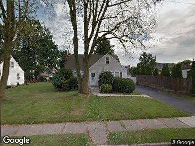
153 High St Woodbridge, NJ 07095
Estimated Value: $469,583 - $547,000
4
Beds
2
Baths
1,405
Sq Ft
$358/Sq Ft
Est. Value
About This Home
This home is located at 153 High St, Woodbridge, NJ 07095 and is currently estimated at $503,396, approximately $358 per square foot. 153 High St is a home located in Middlesex County with nearby schools including Mawbey Street School, Woodbridge Middle School, and Woodbridge High School.
Ownership History
Date
Name
Owned For
Owner Type
Purchase Details
Closed on
Apr 10, 2012
Sold by
Weidner Beverly
Bought by
Mclaughlin Brian and Mclaughlin Elizabeth
Current Estimated Value
Home Financials for this Owner
Home Financials are based on the most recent Mortgage that was taken out on this home.
Original Mortgage
$218,500
Outstanding Balance
$155,565
Interest Rate
3.89%
Mortgage Type
New Conventional
Estimated Equity
$347,994
Create a Home Valuation Report for This Property
The Home Valuation Report is an in-depth analysis detailing your home's value as well as a comparison with similar homes in the area
Home Values in the Area
Average Home Value in this Area
Purchase History
| Date | Buyer | Sale Price | Title Company |
|---|---|---|---|
| Mclaughlin Brian | $230,000 | None Available |
Source: Public Records
Mortgage History
| Date | Status | Borrower | Loan Amount |
|---|---|---|---|
| Open | Mclaughlin Brian | $218,500 |
Source: Public Records
Tax History Compared to Growth
Tax History
| Year | Tax Paid | Tax Assessment Tax Assessment Total Assessment is a certain percentage of the fair market value that is determined by local assessors to be the total taxable value of land and additions on the property. | Land | Improvement |
|---|---|---|---|---|
| 2024 | $9,913 | $75,900 | $26,500 | $49,400 |
| 2023 | $9,913 | $75,100 | $26,500 | $48,600 |
| 2022 | $9,309 | $75,100 | $26,500 | $48,600 |
| 2021 | $9,213 | $75,100 | $26,500 | $48,600 |
| 2020 | $8,910 | $75,100 | $26,500 | $48,600 |
| 2019 | $8,684 | $75,100 | $26,500 | $48,600 |
| 2018 | $8,456 | $75,100 | $26,500 | $48,600 |
| 2017 | $8,285 | $75,100 | $26,500 | $48,600 |
| 2016 | $8,206 | $75,100 | $26,500 | $48,600 |
| 2015 | $8,045 | $75,100 | $26,500 | $48,600 |
| 2014 | $7,853 | $75,100 | $26,500 | $48,600 |
Source: Public Records
Map
Nearby Homes
- 200 Mawbey St
- 527 Linden Ave
- 199 Grove Ave
- 514 Linden Ave
- 179 Decker Place
- 14 Seymour Ave
- 547 Cedar Ave
- 527 E Washington Ave
- 554 Cedar Ave
- 154 Freeman St
- 36 Willry St
- 216 Freeman St
- 108 Freeman St
- 186 Edgar St
- 548 Barron Ave
- 624 Lyman Ave
- 670 Barron Ave
- 233 Martool Dr
- 419 E Middlesex Ave
- 523 Alice Place