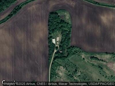
15380 142nd St Norwood Young America, MN 55368
Estimated Value: $448,000 - $642,000
3
Beds
2
Baths
1,897
Sq Ft
$276/Sq Ft
Est. Value
About This Home
This home is located at 15380 142nd St, Norwood Young America, MN 55368 and is currently estimated at $523,494, approximately $275 per square foot. 15380 142nd St is a home located in Carver County with nearby schools including Central Elementary School, Central Middle School, and Central Senior High School.
Ownership History
Date
Name
Owned For
Owner Type
Purchase Details
Closed on
Aug 28, 2023
Sold by
Jorgenson Dennis and Jorgenson Lois
Bought by
Wolter Dereck and Backstrom Meghan
Current Estimated Value
Purchase Details
Closed on
Nov 15, 2021
Sold by
Jorgenson Dennis and Jorgenson Lois
Bought by
Cron Emma and Cron Dakota
Purchase Details
Closed on
Oct 28, 2021
Sold by
Jorgenson Wayne R and Jorgenson Rebecca L
Bought by
Jorgenson Dennis D and Jorgenson Lois E
Create a Home Valuation Report for This Property
The Home Valuation Report is an in-depth analysis detailing your home's value as well as a comparison with similar homes in the area
Home Values in the Area
Average Home Value in this Area
Purchase History
| Date | Buyer | Sale Price | Title Company |
|---|---|---|---|
| Wolter Dereck | $475,000 | -- | |
| Cron Emma | $350,000 | -- | |
| Jorgenson Dennis D | $3,000 | Gilbert Legal Pllc |
Source: Public Records
Mortgage History
| Date | Status | Borrower | Loan Amount |
|---|---|---|---|
| Previous Owner | Jorgenson Dennis D | $140,000 |
Source: Public Records
Tax History Compared to Growth
Tax History
| Year | Tax Paid | Tax Assessment Tax Assessment Total Assessment is a certain percentage of the fair market value that is determined by local assessors to be the total taxable value of land and additions on the property. | Land | Improvement |
|---|---|---|---|---|
| 2024 | $3,992 | $457,800 | $225,000 | $232,800 |
| 2023 | $4,184 | $457,800 | $225,000 | $232,800 |
| 2022 | $3,830 | $477,000 | $237,400 | $239,600 |
| 2021 | $3,360 | $396,100 | $184,400 | $211,700 |
| 2020 | $3,310 | $396,100 | $184,400 | $211,700 |
| 2019 | $2,886 | $354,600 | $167,900 | $186,700 |
| 2018 | $76 | $354,600 | $167,900 | $186,700 |
| 2017 | $2,986 | $339,400 | $158,100 | $181,300 |
| 2016 | $2,716 | $303,800 | $0 | $0 |
| 2015 | $2,340 | $253,300 | $0 | $0 |
| 2014 | $2,340 | $232,300 | $0 | $0 |
Source: Public Records
Map
Nearby Homes
- 13620 County Road 33
- 625 Railroad Dr
- 630 Railroad Dr
- 610-620 Railroad Dr
- 120 Elm St E
- 461 Emma St
- 1013 N Tacoma Ave N
- 211 Wilson St E
- 445 Emma St
- 524 Devonshire Dr
- 13xxx County Road 31
- 414 Central Ave S
- 415 Adams Dr W
- 557 Meadow Ln
- 622 Shoreview Ln
- 105 1st Ave SW
- 16810 County Road 31
- 312 NE 1st St
- 105 5th Ave NE
- 430 Louisa St
