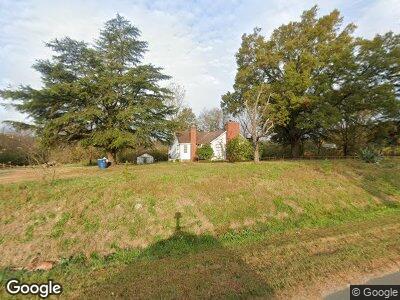
15422 Highway 601 Midland, NC 28107
Estimated Value: $470,000 - $825,000
3
Beds
1
Bath
1,900
Sq Ft
$358/Sq Ft
Est. Value
About This Home
This home is located at 15422 Highway 601, Midland, NC 28107 and is currently estimated at $681,044, approximately $358 per square foot. 15422 Highway 601 is a home located in Cabarrus County with nearby schools including Bethel Elementary School, C.C. Griffin Middle School, and Central Cabarrus High School.
Ownership History
Date
Name
Owned For
Owner Type
Purchase Details
Closed on
Feb 18, 2025
Sold by
Vl Properties Llc
Bought by
S Ashlyn Farms Llc
Current Estimated Value
Purchase Details
Closed on
Jun 12, 2024
Sold by
Bb & T Collateral Service Corp
Bought by
Vl Properties Llc
Purchase Details
Closed on
Mar 28, 2007
Sold by
Park Dae Kyu and Park Sook Hui
Bought by
Goris Maria and Pena Eligio
Home Financials for this Owner
Home Financials are based on the most recent Mortgage that was taken out on this home.
Original Mortgage
$382,500
Interest Rate
6.27%
Mortgage Type
Purchase Money Mortgage
Purchase Details
Closed on
Aug 1, 1996
Create a Home Valuation Report for This Property
The Home Valuation Report is an in-depth analysis detailing your home's value as well as a comparison with similar homes in the area
Home Values in the Area
Average Home Value in this Area
Purchase History
| Date | Buyer | Sale Price | Title Company |
|---|---|---|---|
| S Ashlyn Farms Llc | -- | None Listed On Document | |
| Vl Properties Llc | $451,500 | None Listed On Document | |
| Goris Maria | $450,000 | None Available | |
| -- | $165,000 | -- |
Source: Public Records
Mortgage History
| Date | Status | Borrower | Loan Amount |
|---|---|---|---|
| Previous Owner | Pena Eligio | $1,783,000 | |
| Previous Owner | Goris Maria | $382,500 |
Source: Public Records
Tax History Compared to Growth
Tax History
| Year | Tax Paid | Tax Assessment Tax Assessment Total Assessment is a certain percentage of the fair market value that is determined by local assessors to be the total taxable value of land and additions on the property. | Land | Improvement |
|---|---|---|---|---|
| 2024 | $3,898 | $576,640 | $383,800 | $192,840 |
| 2023 | $2,614 | $311,200 | $191,900 | $119,300 |
| 2022 | $2,614 | $311,200 | $191,900 | $119,300 |
| 2021 | $2,614 | $311,200 | $191,900 | $119,300 |
| 2020 | $2,614 | $311,200 | $191,900 | $119,300 |
| 2019 | $2,699 | $321,340 | $233,100 | $88,240 |
| 2018 | $2,571 | $321,340 | $233,100 | $88,240 |
| 2017 | $2,506 | $321,340 | $233,100 | $88,240 |
| 2016 | $2,506 | $372,480 | $288,600 | $83,880 |
| 2015 | $2,846 | $372,480 | $288,600 | $83,880 |
| 2014 | $2,846 | $372,480 | $288,600 | $83,880 |
Source: Public Records
Map
Nearby Homes
- 15554 Highway 601 Hwy S
- 3305 Drake Rd
- 3605 Libby Ln
- 15670 Bethel Avenue Extension
- 14841 S Hwy 601 Hwy
- 16160 Hopewell Church Rd
- 420 Woodlark Ct
- 109 Brief Rd W
- 14022 Clayborn St
- 14034 Clayborn St Unit 28
- 14027 Clayborn St
- 14073 Clayborn St
- 13969 Clayborn St
- 9515 Concord Hwy
- 1135 Ben Black Rd
- 13670 Highway 601 Hwy
- 4375 Creek Ave
- 9721 Kerr Rd
- 1473 Polk Ford Rd
- 4470 Kingsbury Dr