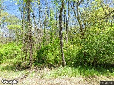
1543 Morris Rd Lansdale, PA 19446
Estimated Value: $928,000 - $1,235,000
4
Beds
4
Baths
4,970
Sq Ft
$221/Sq Ft
Est. Value
About This Home
This home is located at 1543 Morris Rd, Lansdale, PA 19446 and is currently estimated at $1,099,908, approximately $221 per square foot. 1543 Morris Rd is a home located in Montgomery County with nearby schools including General Nash El School, Pennfield Middle School, and North Penn Senior High School.
Ownership History
Date
Name
Owned For
Owner Type
Purchase Details
Closed on
Dec 17, 1999
Sold by
Six Sloane
Bought by
Robison Peter A and Robison Barbara S
Current Estimated Value
Purchase Details
Closed on
May 14, 1999
Sold by
Harris Michael and Harris Denise A
Bought by
Six Sloane
Purchase Details
Closed on
Sep 30, 1996
Sold by
Jauss Joseph G
Bought by
Harris Michael and Harris Denise A
Create a Home Valuation Report for This Property
The Home Valuation Report is an in-depth analysis detailing your home's value as well as a comparison with similar homes in the area
Home Values in the Area
Average Home Value in this Area
Purchase History
| Date | Buyer | Sale Price | Title Company |
|---|---|---|---|
| Robison Peter A | $25,000 | -- | |
| Six Sloane | $137,000 | -- | |
| Harris Michael | $123,500 | -- |
Source: Public Records
Mortgage History
| Date | Status | Borrower | Loan Amount |
|---|---|---|---|
| Open | Webb Richard E | $345,000 | |
| Closed | Webb Richard E | $403,000 | |
| Closed | Webb Richard E | $104,000 | |
| Closed | Webb Richard E | $500,000 | |
| Closed | Webb Richard E | $400,000 | |
| Closed | Webb Deborah P | $40,574 | |
| Closed | Webb Richard E | $361,900 | |
| Closed | Webb Richard E | $319,000 | |
| Closed | Webb Richard E | $411,000 |
Source: Public Records
Tax History Compared to Growth
Tax History
| Year | Tax Paid | Tax Assessment Tax Assessment Total Assessment is a certain percentage of the fair market value that is determined by local assessors to be the total taxable value of land and additions on the property. | Land | Improvement |
|---|---|---|---|---|
| 2024 | $20,287 | $500,870 | $158,590 | $342,280 |
| 2023 | $19,427 | $500,870 | $158,590 | $342,280 |
| 2022 | $18,236 | $500,870 | $158,590 | $342,280 |
| 2021 | $17,708 | $500,870 | $158,590 | $342,280 |
| 2020 | $16,906 | $500,870 | $158,590 | $342,280 |
| 2019 | $16,612 | $500,870 | $158,590 | $342,280 |
| 2018 | $3,664 | $500,870 | $158,590 | $342,280 |
| 2017 | $15,951 | $500,870 | $158,590 | $342,280 |
| 2016 | $15,756 | $500,870 | $158,590 | $342,280 |
| 2015 | $15,097 | $500,870 | $158,590 | $342,280 |
| 2014 | $15,097 | $500,870 | $158,590 | $342,280 |
Source: Public Records
Map
Nearby Homes
- 1900 Rampart Ln
- 1895 Rampart Ln
- 1500 Liberty Bell Dr
- 1780 Kriebel Rd
- 102 Continental Dr Unit CONDO 287
- 205 Bunker Hill Rd Unit 121
- 505 Bunker Hill Rd
- 2245 Kerr Rd
- 580 Harrington Ct
- 1505 Fairview Way
- 552 Greenwood Ct
- 1210 Bridle Path Dr
- 1041 Hunter Hill Dr
- 218 Candlewood Way
- 3044 Conrad Way
- 1929 Old Forty Foot Rd
- 1896 S Valley Forge Rd
- 1495 Maxwell Ct
- 1410 Village Way
- 958 Musket Dr
