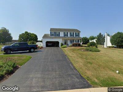
16 Brook Meadow Cir Shrewsbury, PA 17361
Shrewsbury NeighborhoodEstimated Value: $239,000 - $390,000
4
Beds
3
Baths
1,778
Sq Ft
$192/Sq Ft
Est. Value
About This Home
This home is located at 16 Brook Meadow Cir, Shrewsbury, PA 17361 and is currently estimated at $341,436, approximately $192 per square foot. 16 Brook Meadow Cir is a home located in York County with nearby schools including Susquehannock High School, St John The Baptist Catholic School, and Shrewsbury Christian Academy.
Ownership History
Date
Name
Owned For
Owner Type
Purchase Details
Closed on
Mar 7, 2017
Sold by
Deno Homes Llc
Bought by
Piermatteo Joshua D
Current Estimated Value
Home Financials for this Owner
Home Financials are based on the most recent Mortgage that was taken out on this home.
Original Mortgage
$128,282
Interest Rate
4.19%
Mortgage Type
New Conventional
Purchase Details
Closed on
Jan 24, 1992
Sold by
Rylea Homes Inc
Bought by
Piermatteo Philip A and Piermatteo Sharon D
Purchase Details
Closed on
Oct 15, 1991
Bought by
Rylea Homes Inc
Create a Home Valuation Report for This Property
The Home Valuation Report is an in-depth analysis detailing your home's value as well as a comparison with similar homes in the area
Home Values in the Area
Average Home Value in this Area
Purchase History
| Date | Buyer | Sale Price | Title Company |
|---|---|---|---|
| Piermatteo Joshua D | $127,000 | None Available | |
| Piermatteo Philip A | $162,800 | -- | |
| Rylea Homes Inc | $74,200 | -- |
Source: Public Records
Mortgage History
| Date | Status | Borrower | Loan Amount |
|---|---|---|---|
| Open | Piermatteo Philip A | $191,500 | |
| Closed | Piermatteo Joshua D | $128,282 | |
| Previous Owner | Piermatteo Philip A | $237,840 | |
| Previous Owner | Piermatteo Philip A | $50,000 |
Source: Public Records
Tax History Compared to Growth
Tax History
| Year | Tax Paid | Tax Assessment Tax Assessment Total Assessment is a certain percentage of the fair market value that is determined by local assessors to be the total taxable value of land and additions on the property. | Land | Improvement |
|---|---|---|---|---|
| 2024 | $5,763 | $202,130 | $54,160 | $147,970 |
| 2023 | $5,763 | $202,130 | $54,160 | $147,970 |
| 2022 | $5,763 | $202,130 | $54,160 | $147,970 |
| 2021 | $5,540 | $202,130 | $54,160 | $147,970 |
| 2020 | $5,540 | $202,130 | $54,160 | $147,970 |
| 2019 | $5,520 | $202,130 | $54,160 | $147,970 |
| 2018 | $5,425 | $202,130 | $54,160 | $147,970 |
| 2017 | $5,247 | $202,130 | $54,160 | $147,970 |
| 2016 | $0 | $202,130 | $54,160 | $147,970 |
| 2015 | -- | $202,130 | $54,160 | $147,970 |
| 2014 | -- | $202,130 | $54,160 | $147,970 |
Source: Public Records
Map
Nearby Homes
- 112 Skyview Dr
- 0 Lot 11 Harambe Overlook Unit PAYK2064444
- 0 Lot 10 Harambe Overlook Unit PAYK2039860
- 0 Lot 8 Harambe Overlook Unit PAYK2039856
- 0 Lot 7 Harambe Overlook Unit PAYK2039852
- 0 Lot 6 Harambe Overlook Unit PAYK2039850
- 12 Brookview Ln
- 18 20 N Main St
- 223 W Forrest Ave
- 224 W Forrest Ave
- 771 Juli Dr
- 202 S Main St
- 16554 Kennedy Cir
- 7 Kratz Rd
- 16542 Kennedy Cir
- 216 S Sunset Dr
- 12719 Wolfe Rd
- 610 E Tolna Rd Unit DEVONSHIRE
- 610 E Tolna Rd Unit HAWTHORNE
- 610 E Tolna Rd Unit SAVANNAH